Publications
Check out our peer-reviewed articles below! You can browse through the summaries and key figures, which are ordered chronologically and separated into years (you can also skip to specific years using the links below). Authors in bold represent group members. Each paper also includes a “Read more!” link so that you can click through to access full papers and learn more about each study. Feel free to reach out if you need access!
– 2024 –
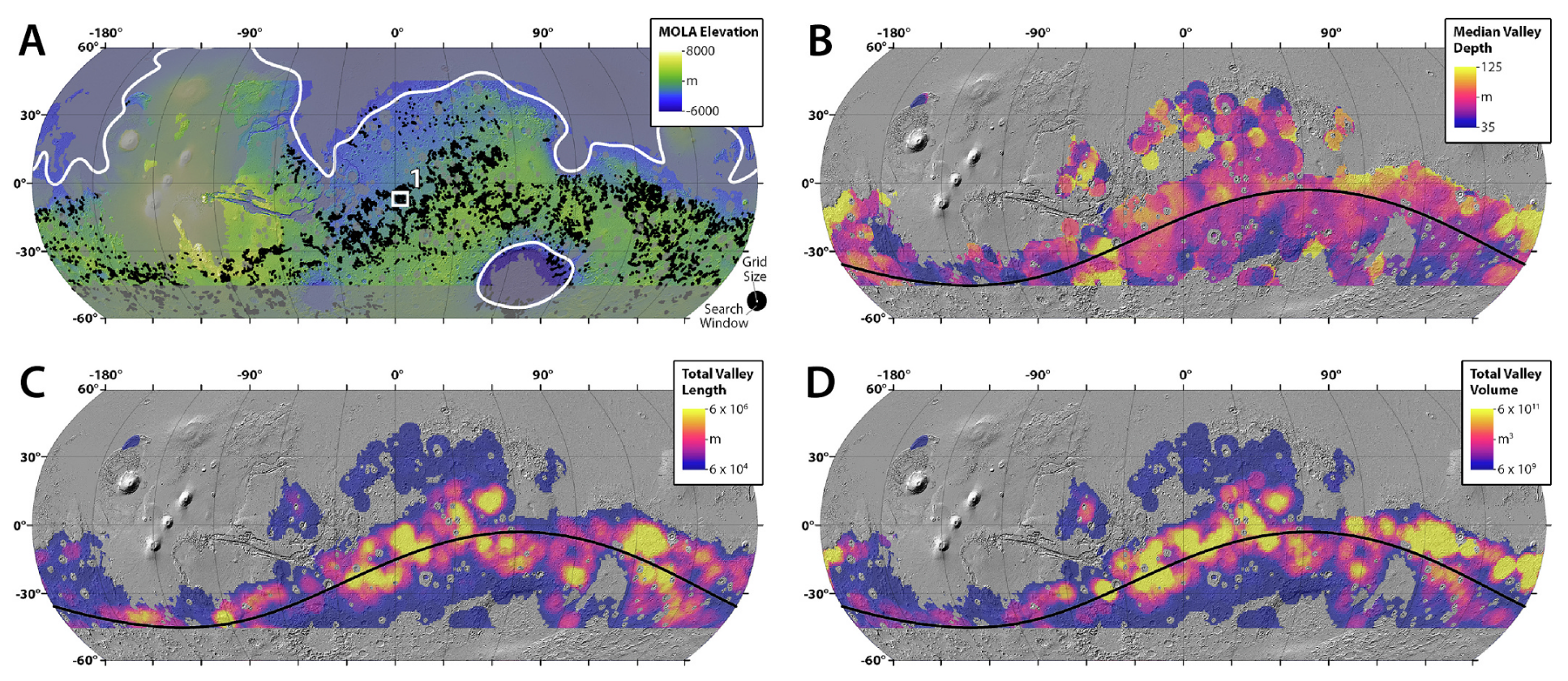
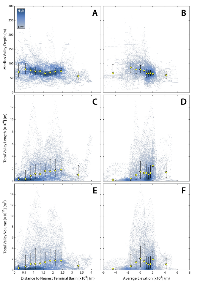
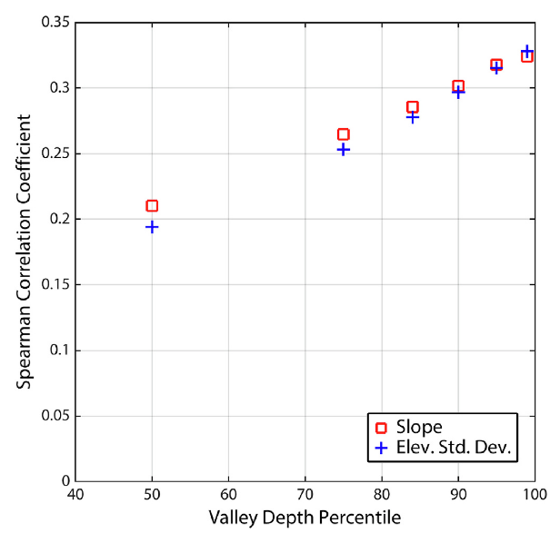
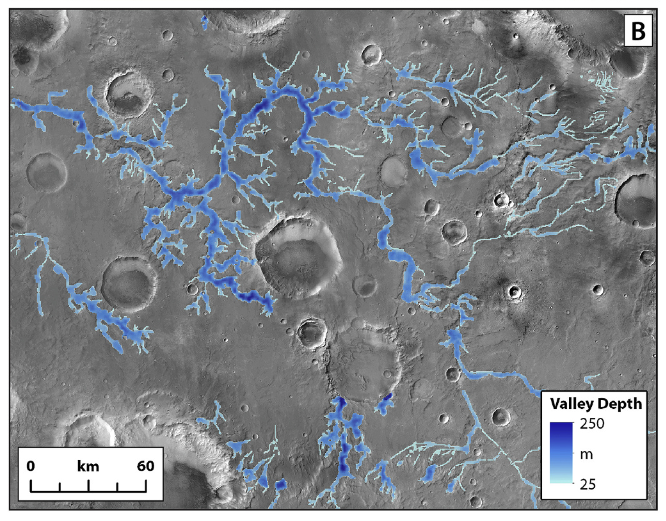
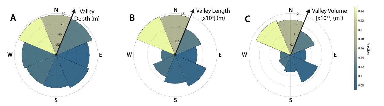
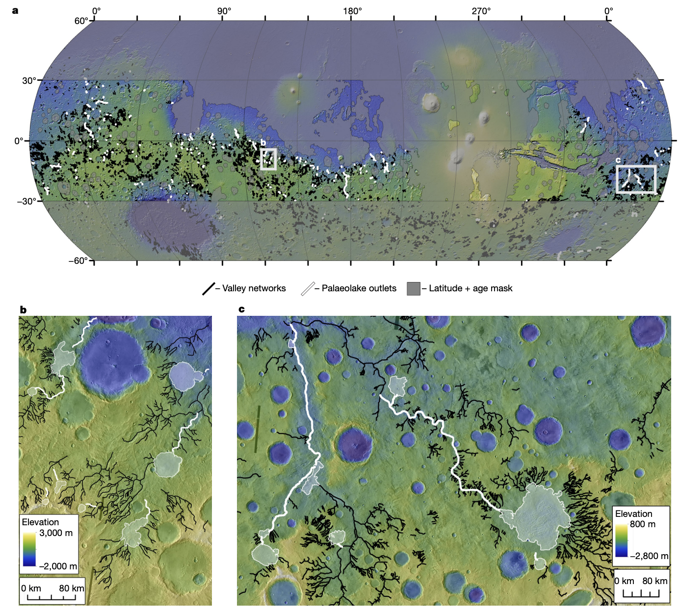
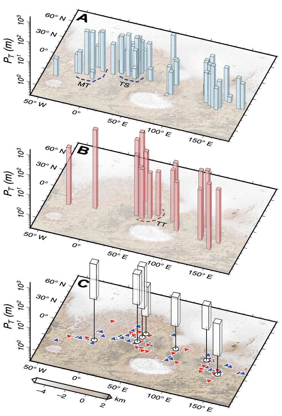
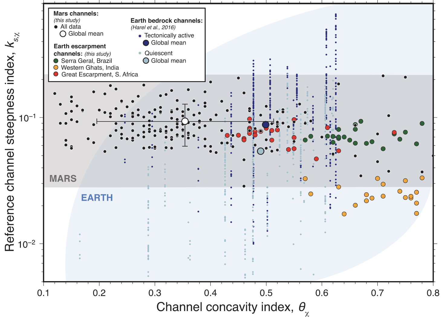
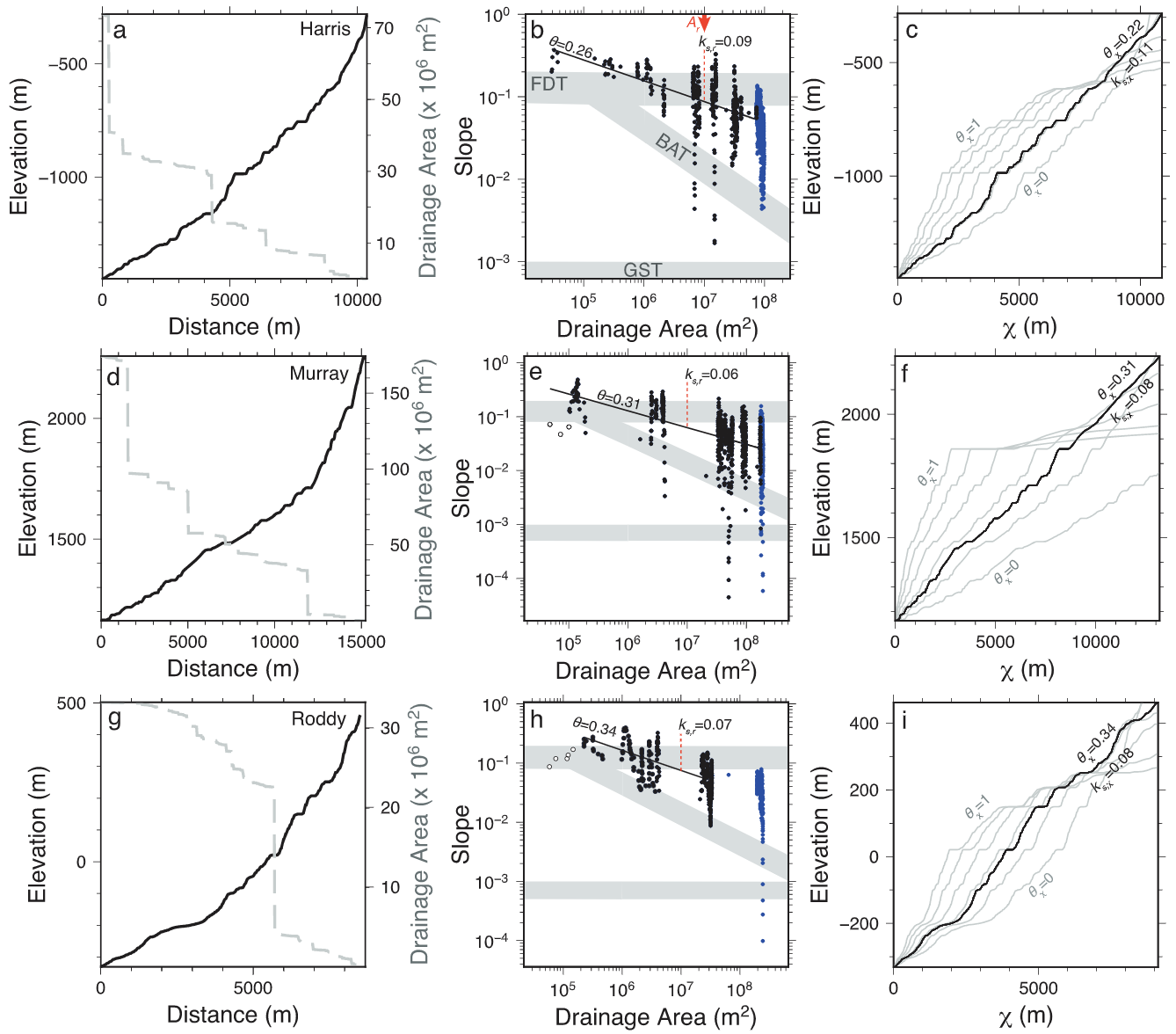
Spatial patterns of valley network erosion on early Mars – Icarus
Timothy Goudge, Alex Morgan, Gaia Stucky de Quay & Caleb Fassett
Usually we tend to study valley networks on Mars by looking at the shape of valley networks… However, we now have this neat dataset of global erosion depths, which allows us to understand the geographic distribution of Mars’ hydrologic system in much more detail! Here we find that valley depth depends on regional slope and landscape relief. More suprisingly, there is a peak in eroded volume near a paleo-latitude band — before true polar wander on Mars!
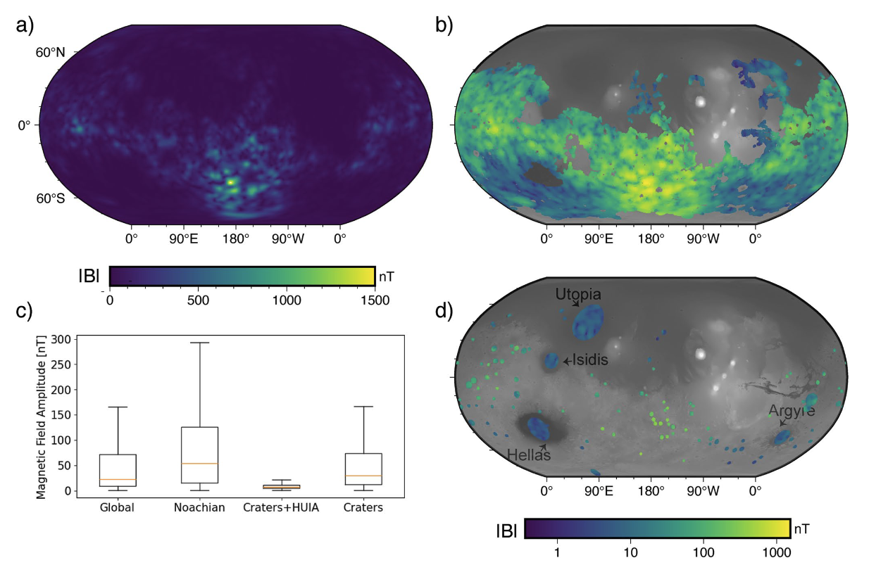
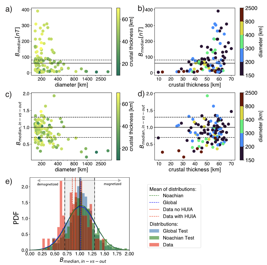
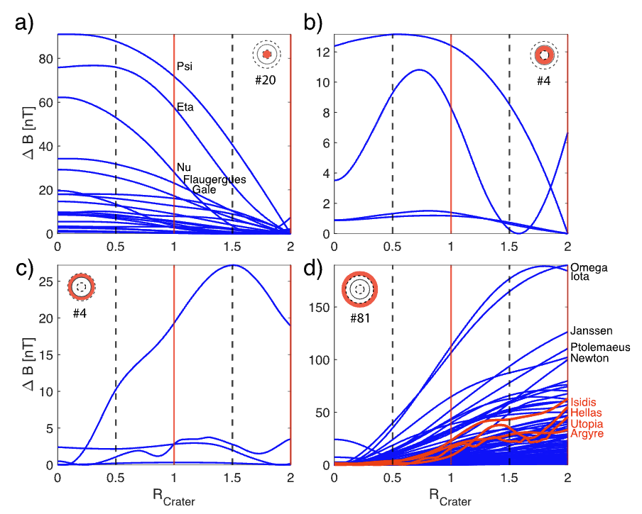
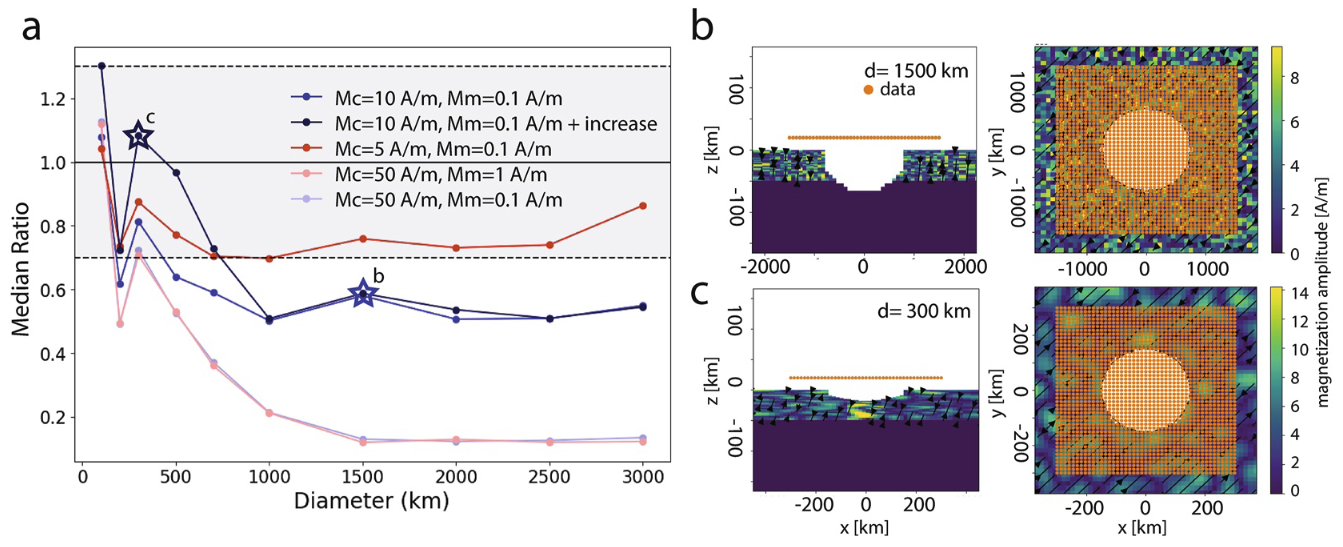
Magnetic Field Signatures of Craters on Mars – GRL
Anna Mittelholz, Sarah Steele, (…) & Gaia Stucky de Quay
Craters on Mars are a unique window into Mars’ past, since they record the processes that were happening at the time of formation. In the context of its magnetic field, during an impact the crust is heated and shocked and recrystallization occurs; craters can thus demagnetize or magnetize the crust depending on the presence or absence of a dynamo field at the time. Here, we find that many craters exhibit a demagnetization signature, even the very old ones — thus, it seems like magnetization of craters not a reliable indicator for dynamo activity!
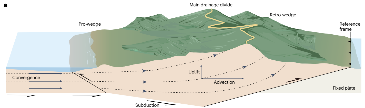
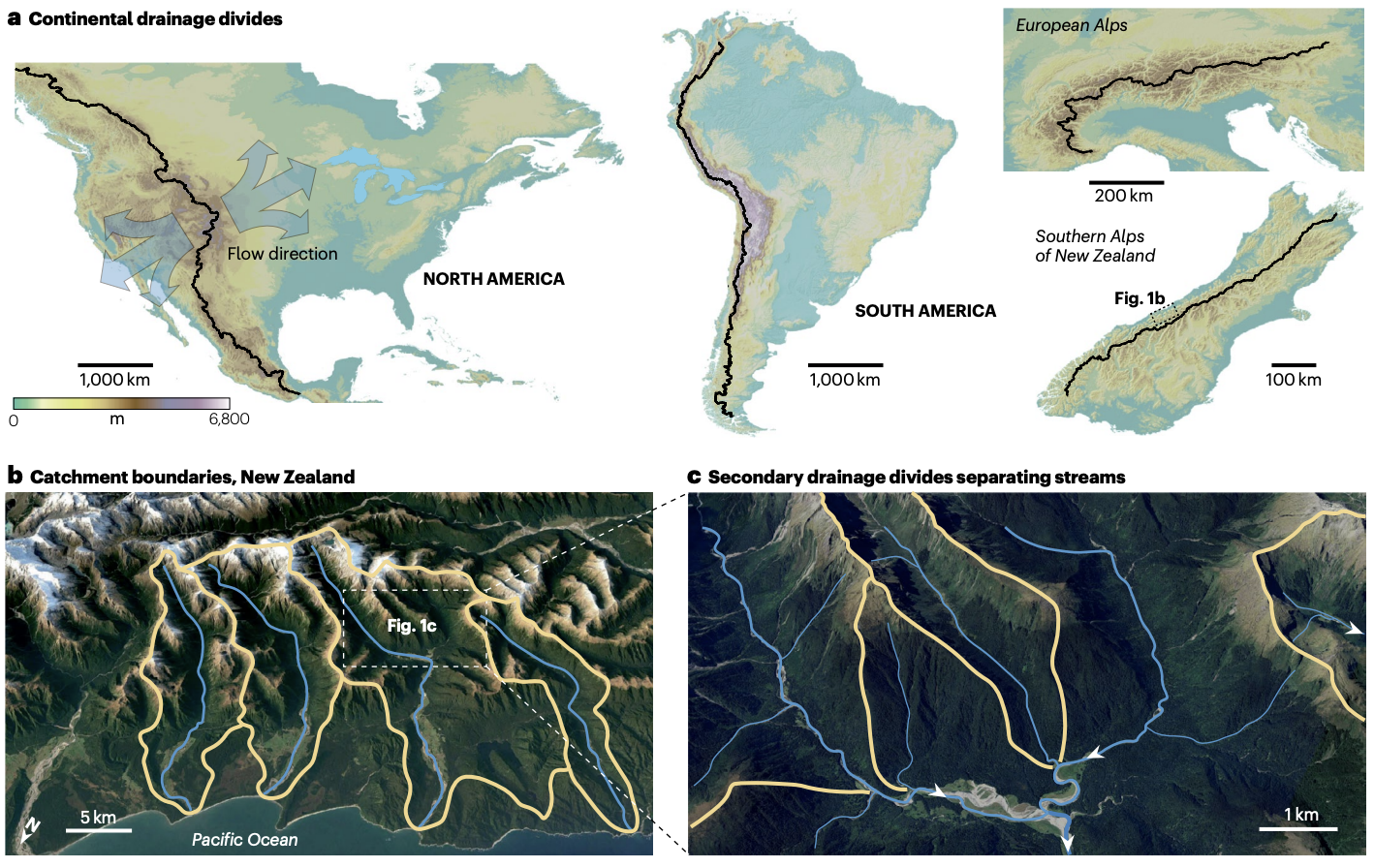
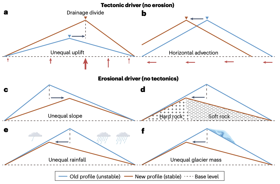
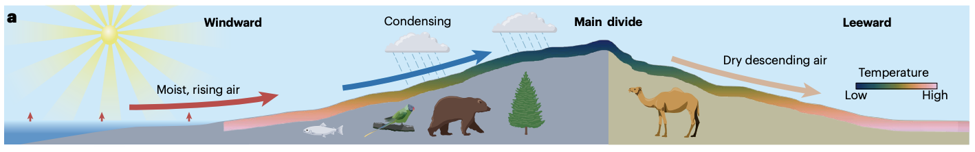
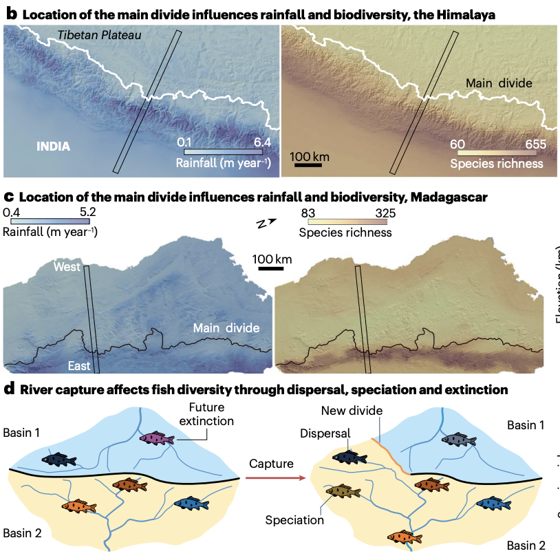
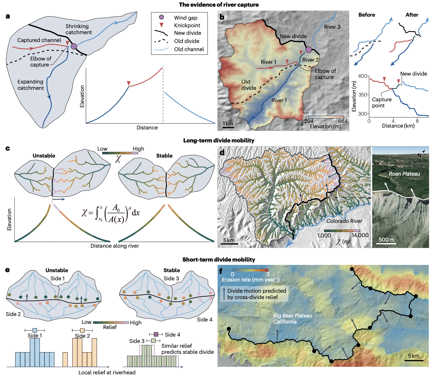
Drainage divide migration and implications for climate and biodiversity – Nature Reviews: Earth and Environment
Chuanqi He, Jean Braun, (…) & Gaia Stucky de Quay
What are drainage divides? These key features are a topographic boundary that separates surface water flow. More importantly, they are dynamic features of our planet’s surface that shape hydrology, sedimentation, carbon cycling, and ultimately, the connectivity of landscapes. Here we break down the main processes that dictate migration (e.g., tectonics vs. climate), the controls and rates, as well as the implications and future perspectives. For example, main drainage divide position of mountains affects spatial patterns
of rainfall via orographic effect and temperature through altitude–temperature relationship, thereby influencing the richness and type
of species.
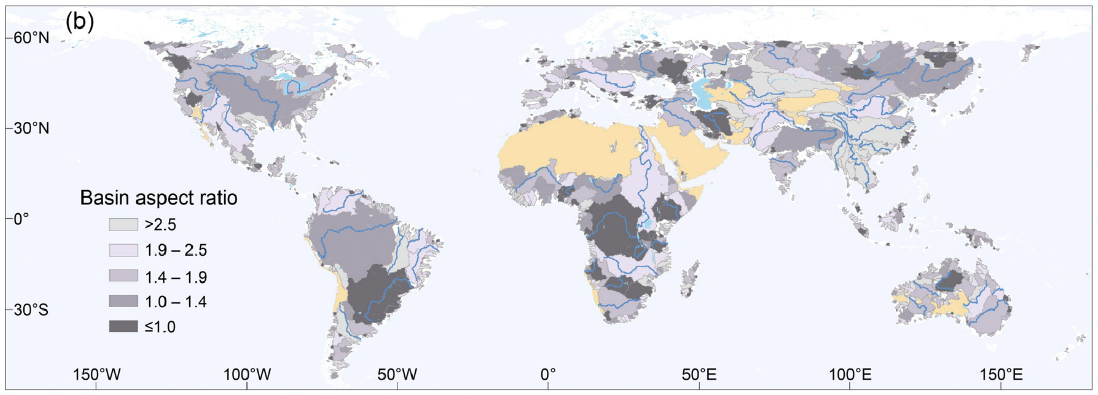
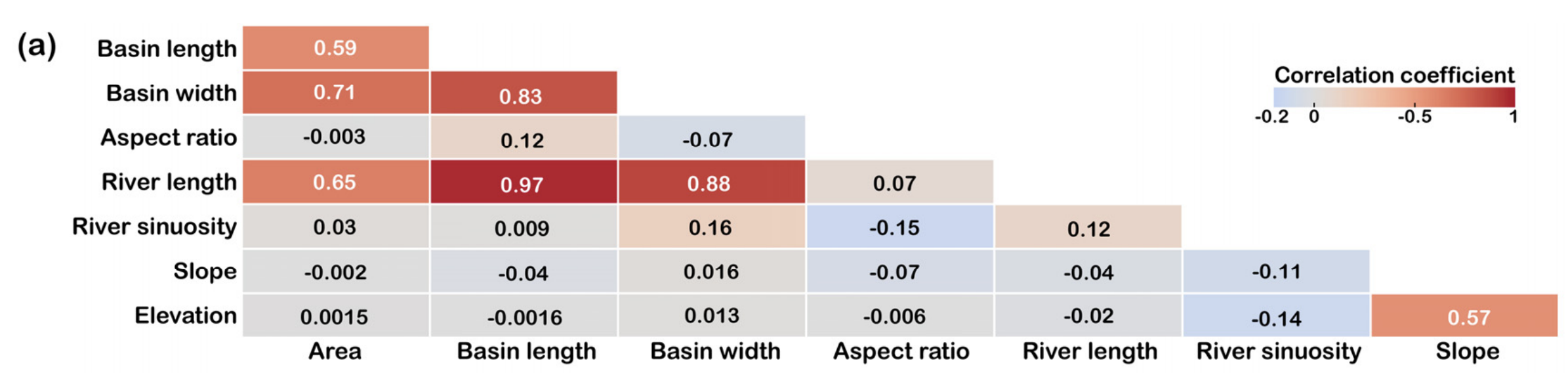
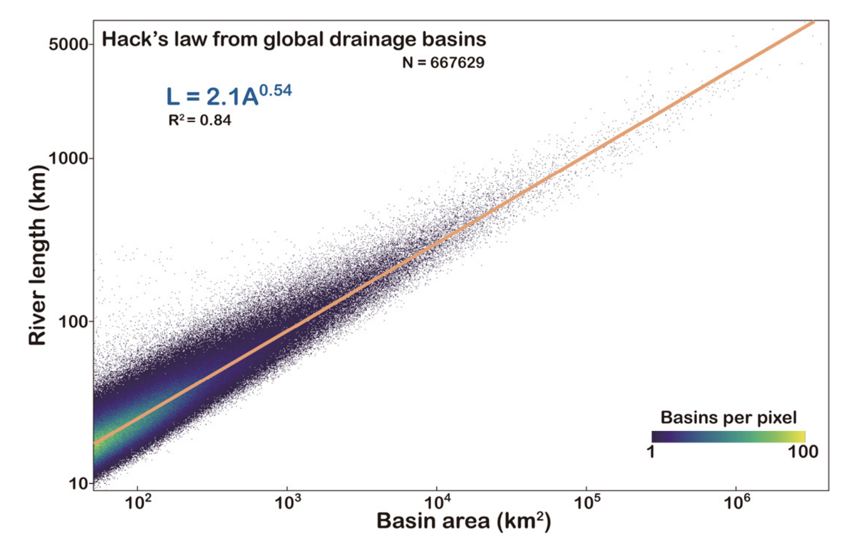
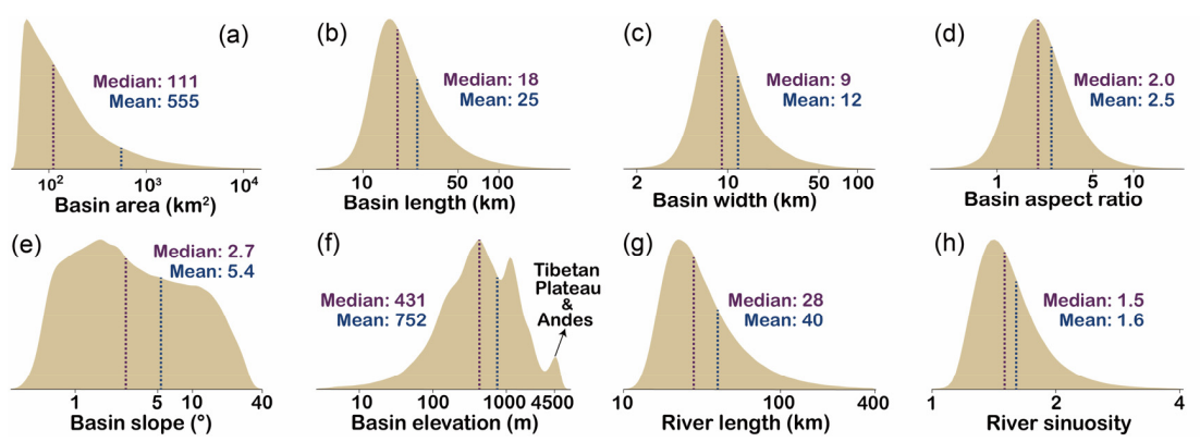
A global dataset of the shape of drainage systems – Earth System Science Data
Chuanqi He, Ci-Jian Yang, (…) & Gaia Stucky de Quay
What do basin shapes look like at a global scale? How do they vary geographically? What laws dictate their geometries? In this data paper we compile a database of over half a million basins and their main river trunk. This is a great dataset for examining the forces that dictate fluvial geometries, completed using a topographic resolution of 90 meters!
– 2023 –
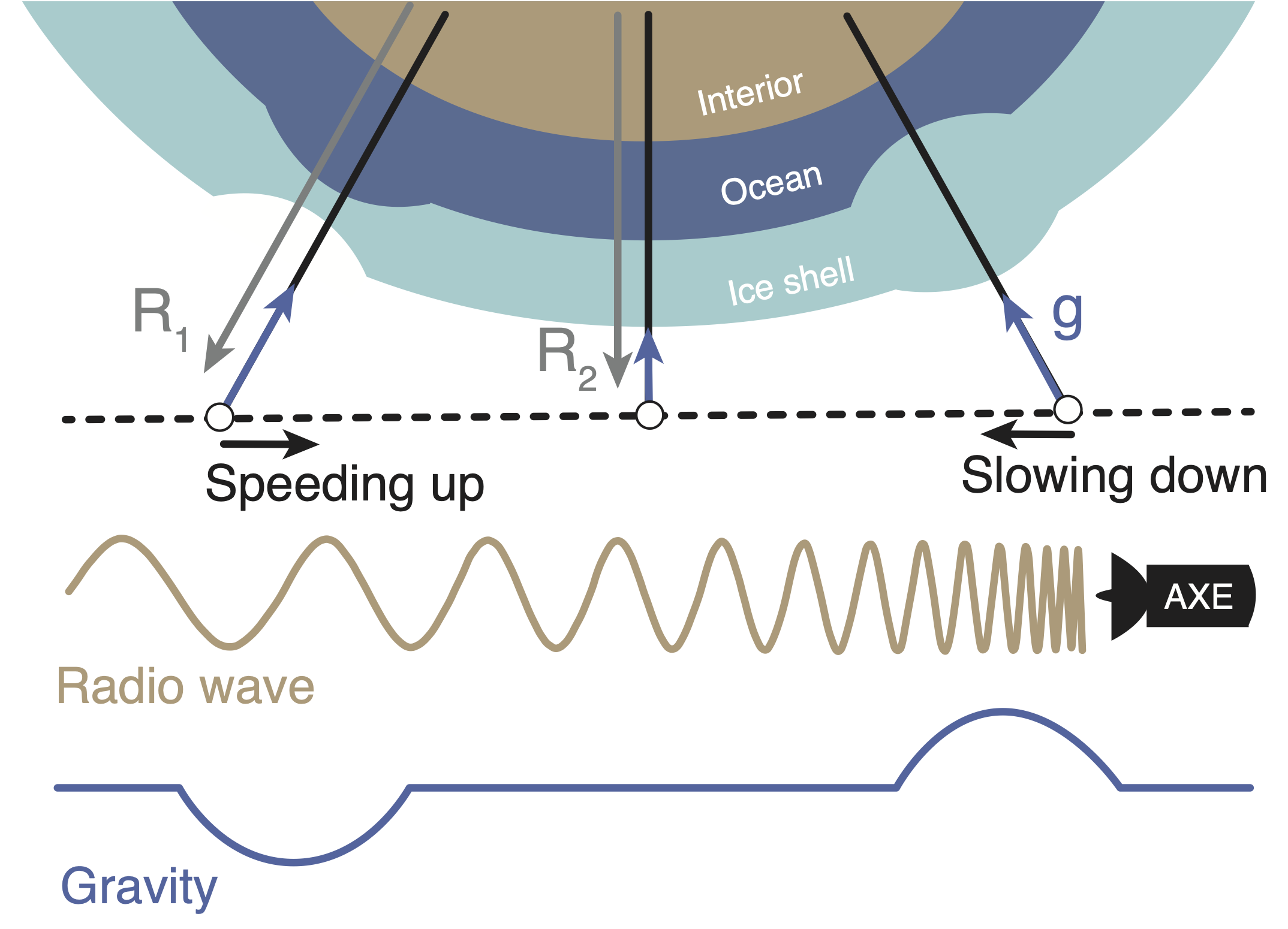
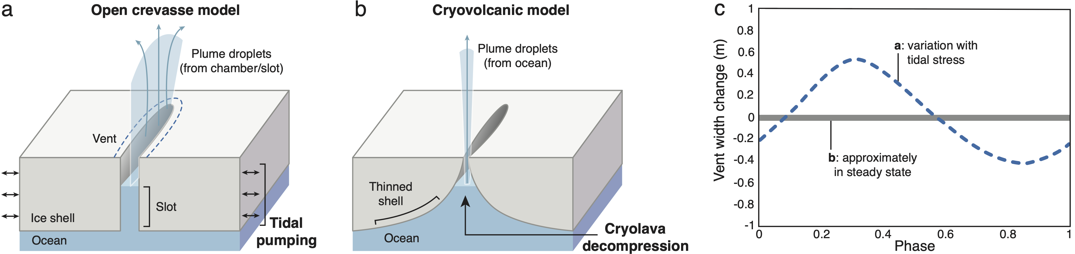
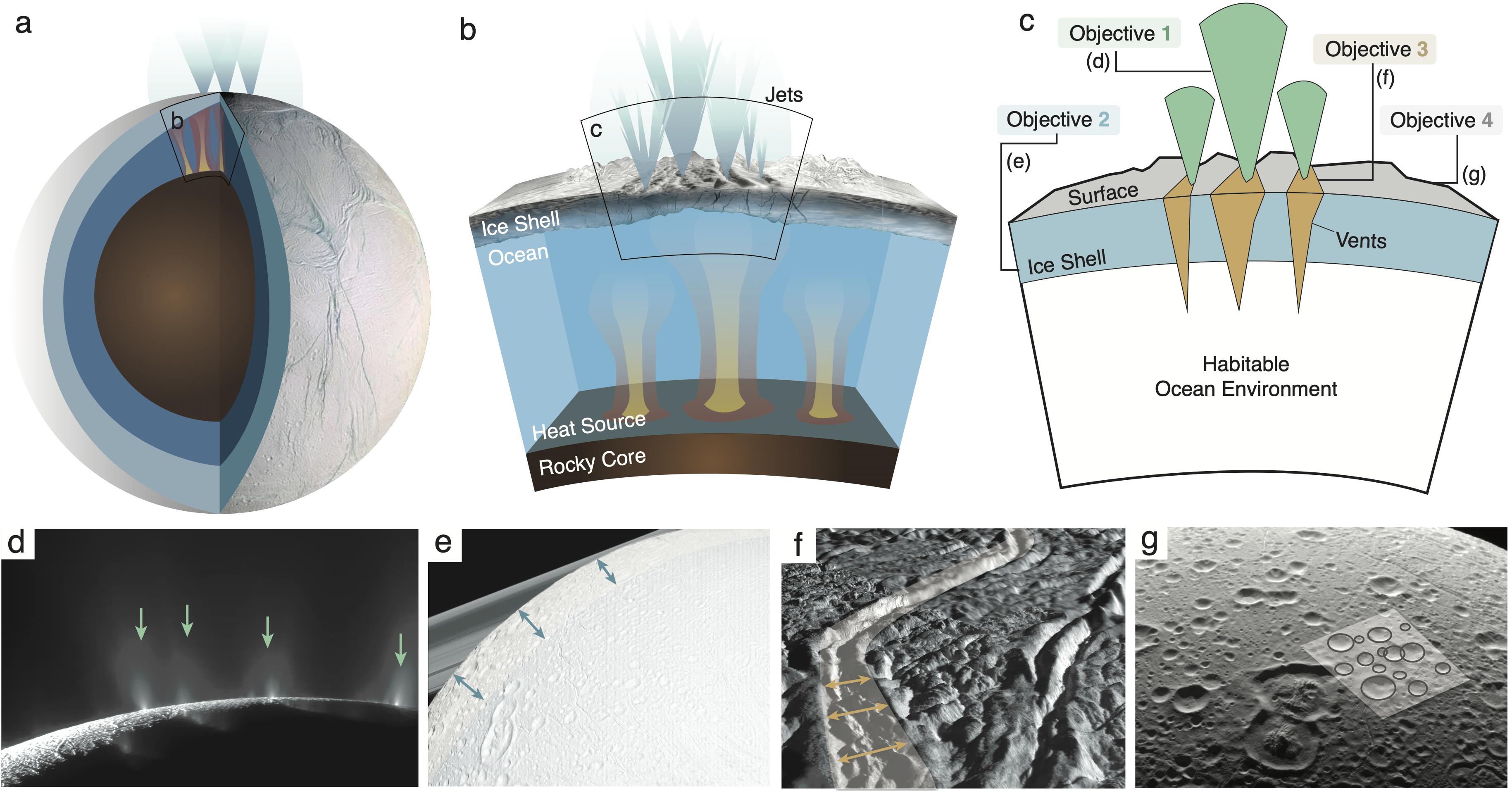
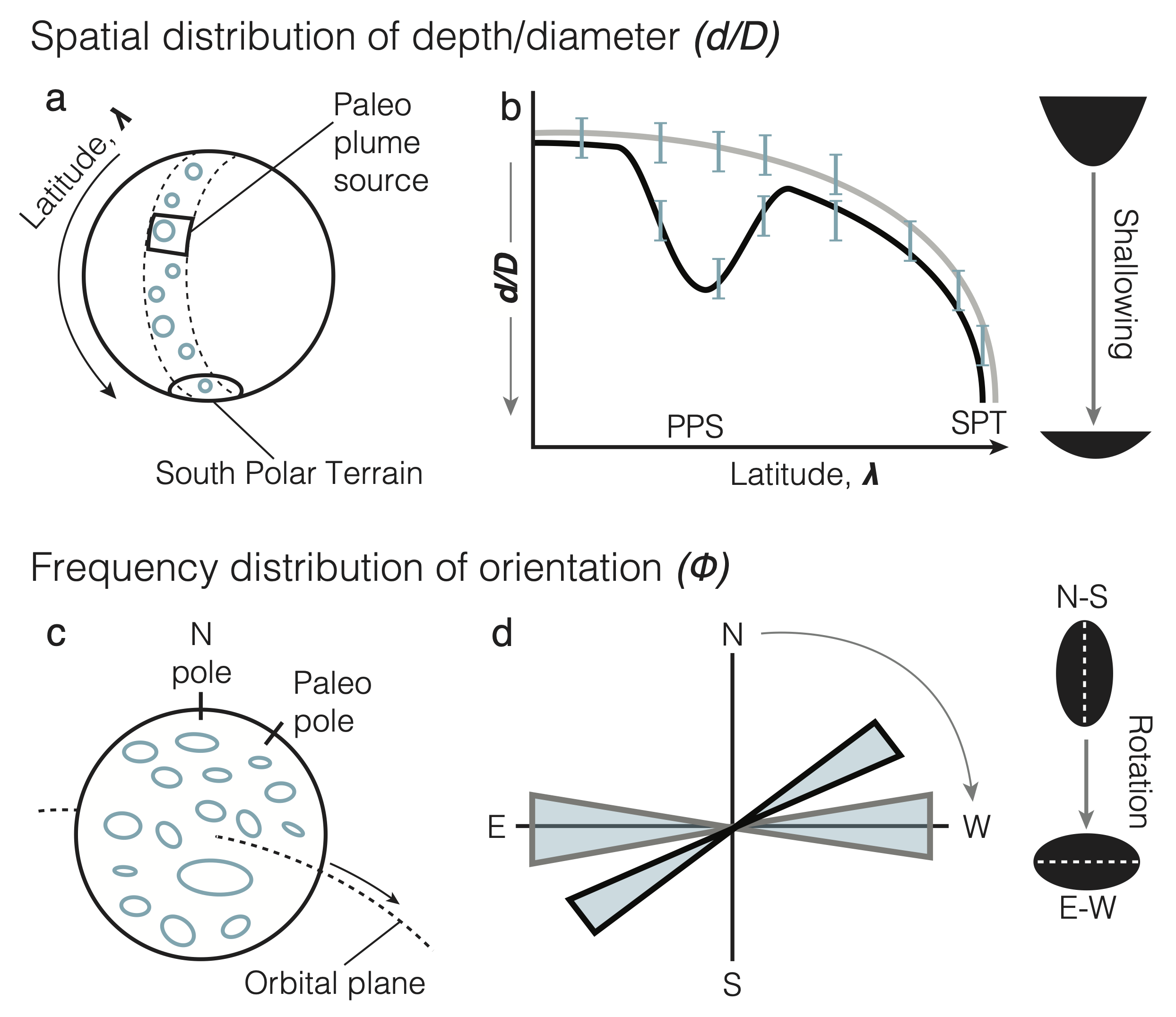
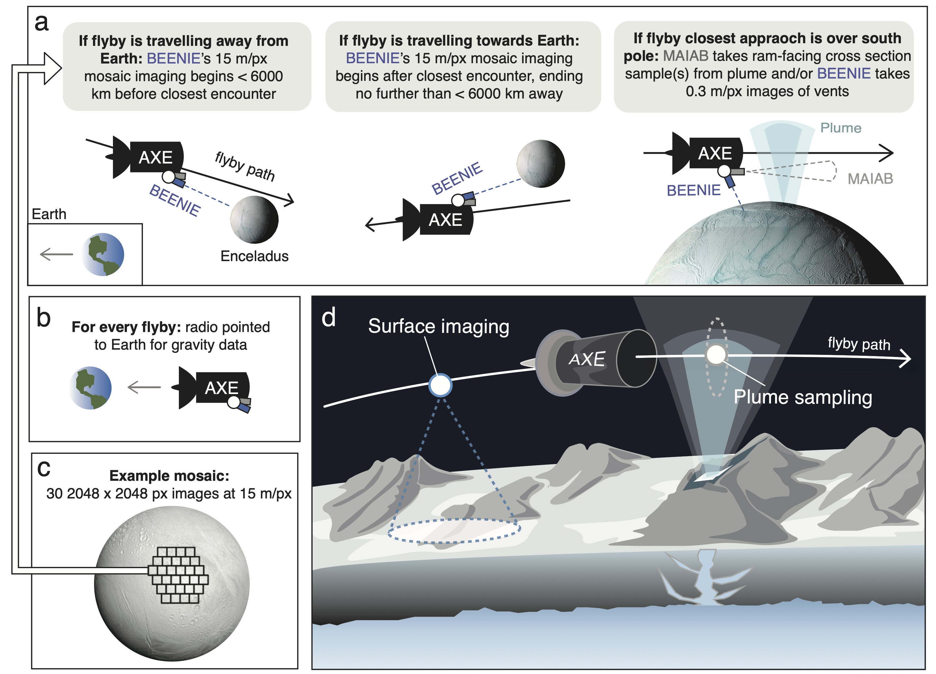
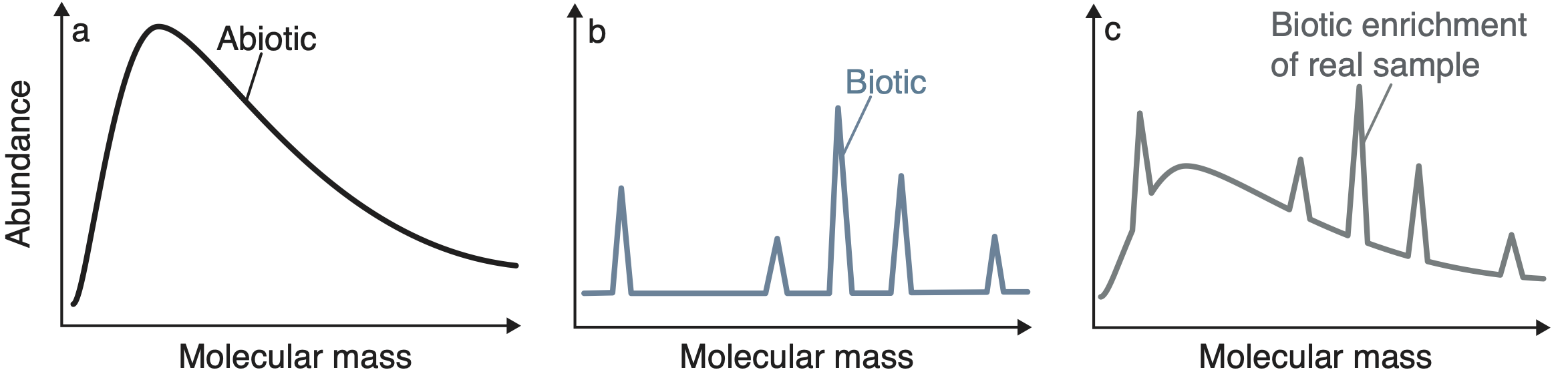
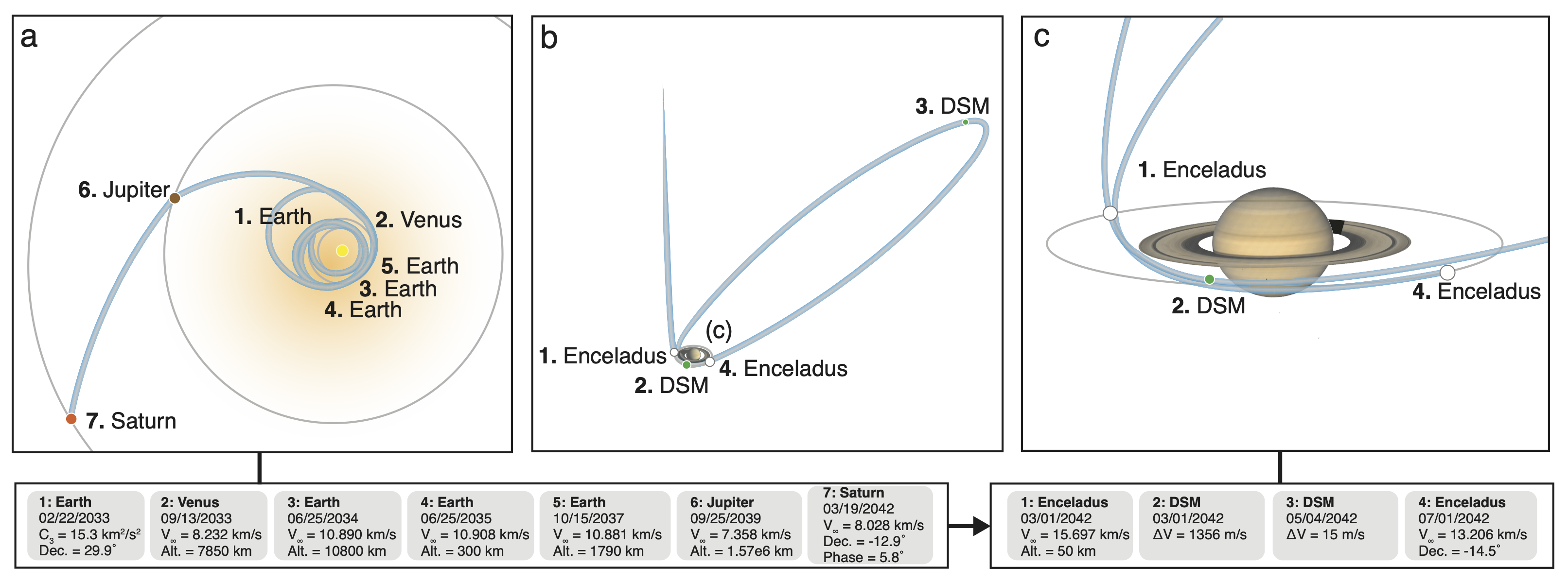
Astrobiology eXploration at Enceladus (AXE): A New Frontiers Mission Concept Study – PSJ [In review]
K. Marshall Seaton , Szilard Gyalay, Gaia Stucky de Quay et al.
Here we lay out our concept for an Enceladus mission, which we developed during the JPL Planetary Science Summer School (PSSS). Check out the link for applying here! In this concept study, we tackle four key science objectives that will shed much light on Enceladus, Saturn’s tiny – but mighty – moon. First we look at biotic signatures in its famous giant water plume. Second, we use gravity measurements to explore its ice shell thickness and dynamics. Third, we explore the cryovolcanic nature of the vents. Finally, we look at the global distribution of crater morphology to determine ancient ice shell orientations.

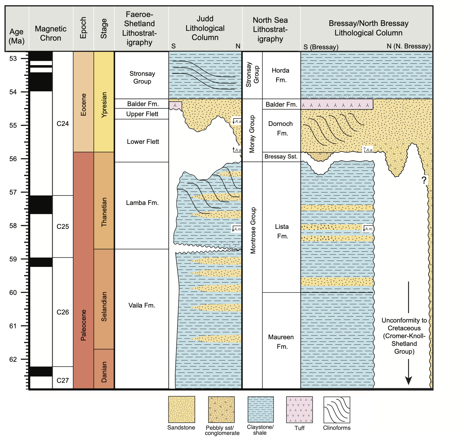
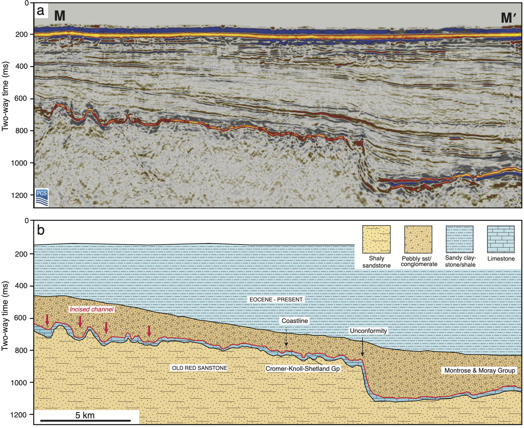
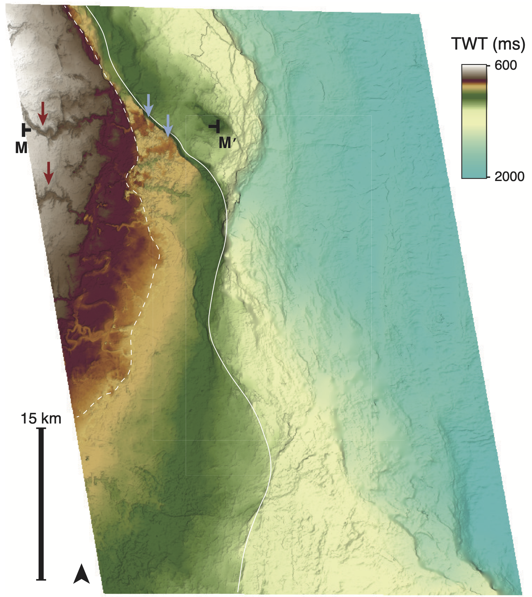
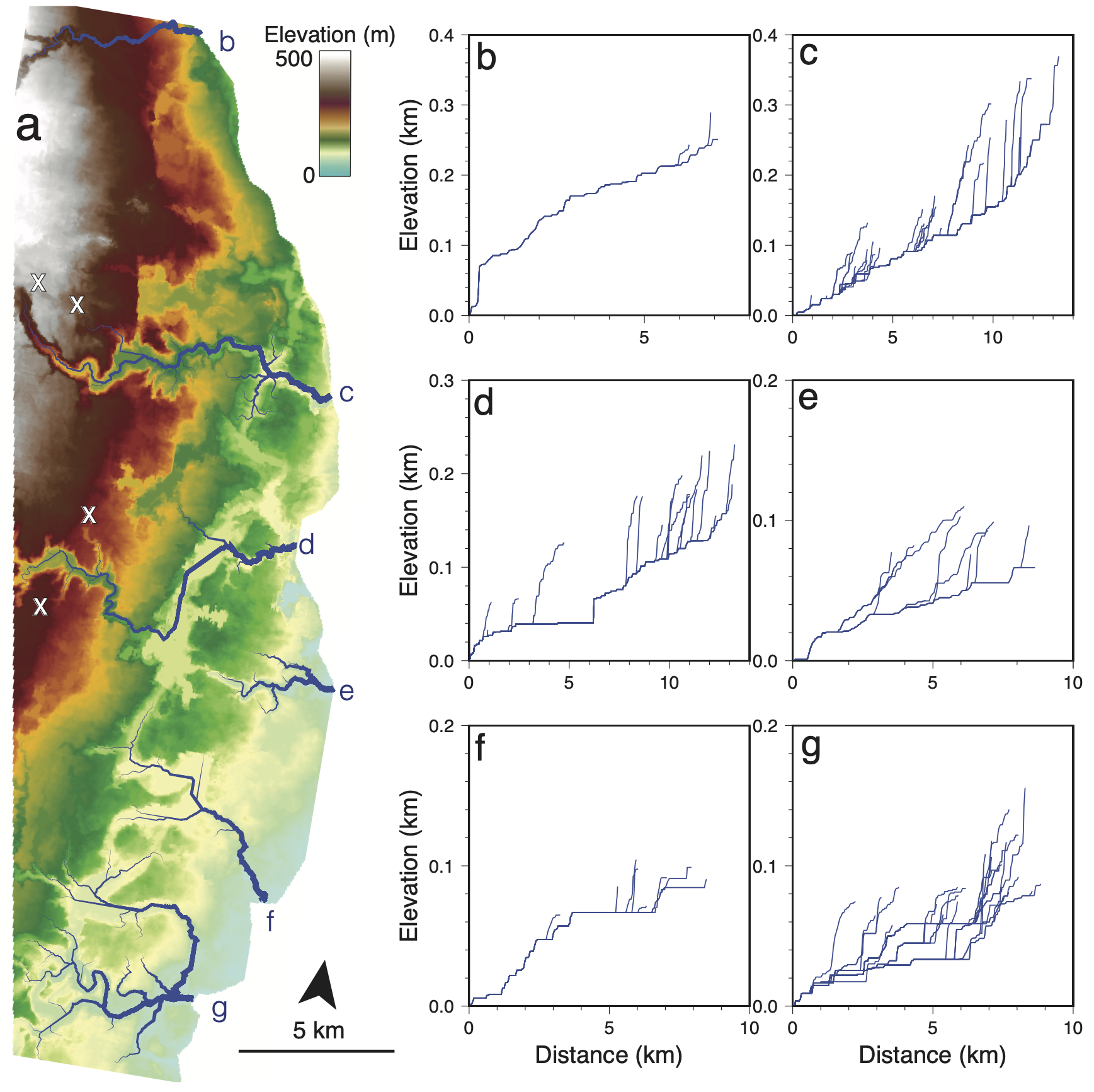
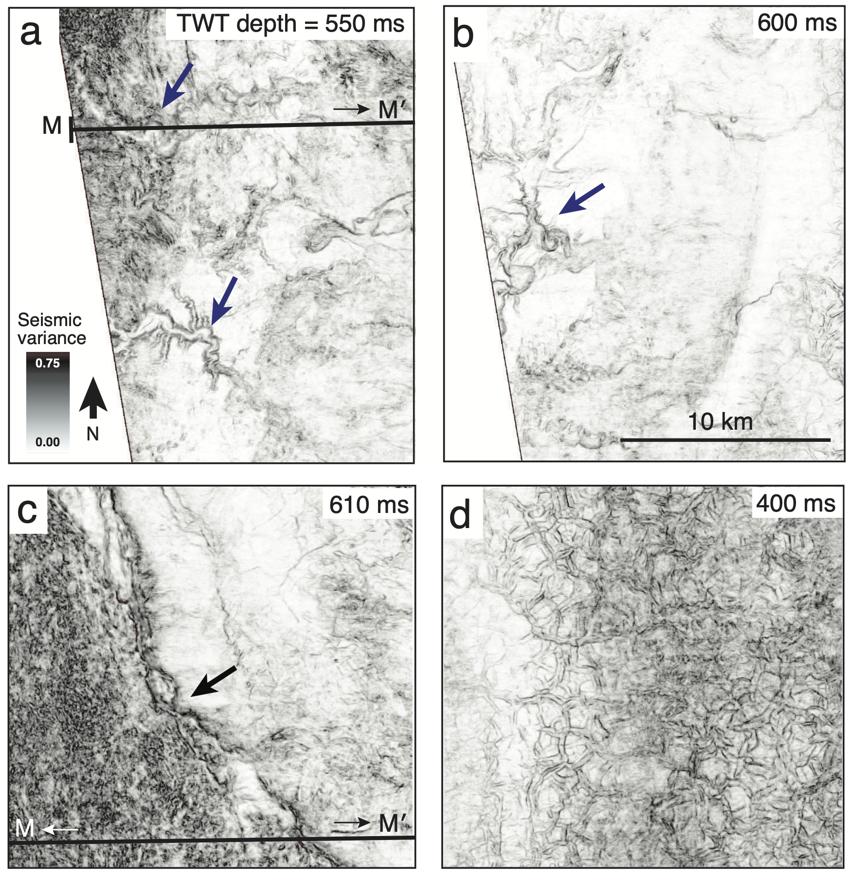
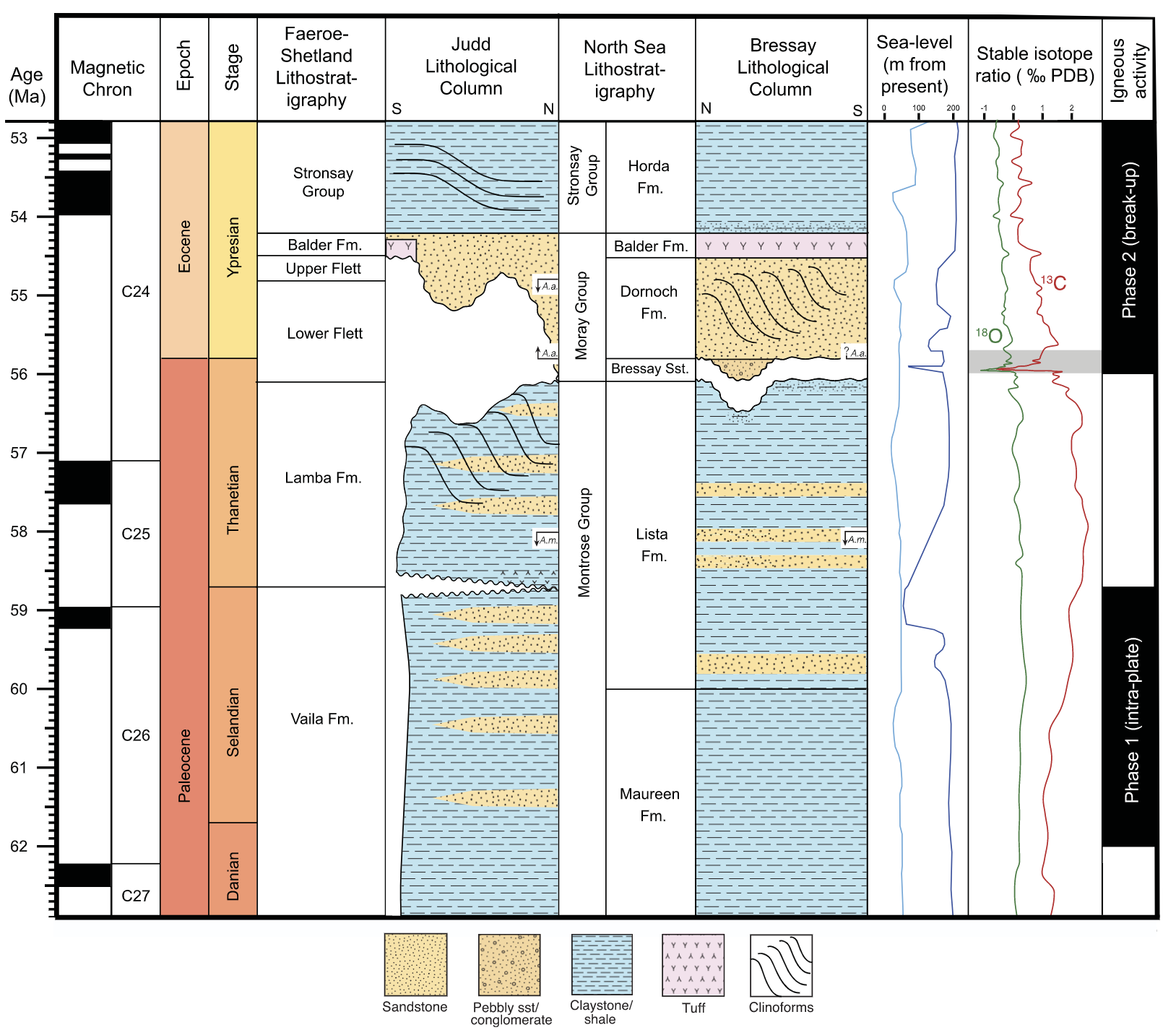
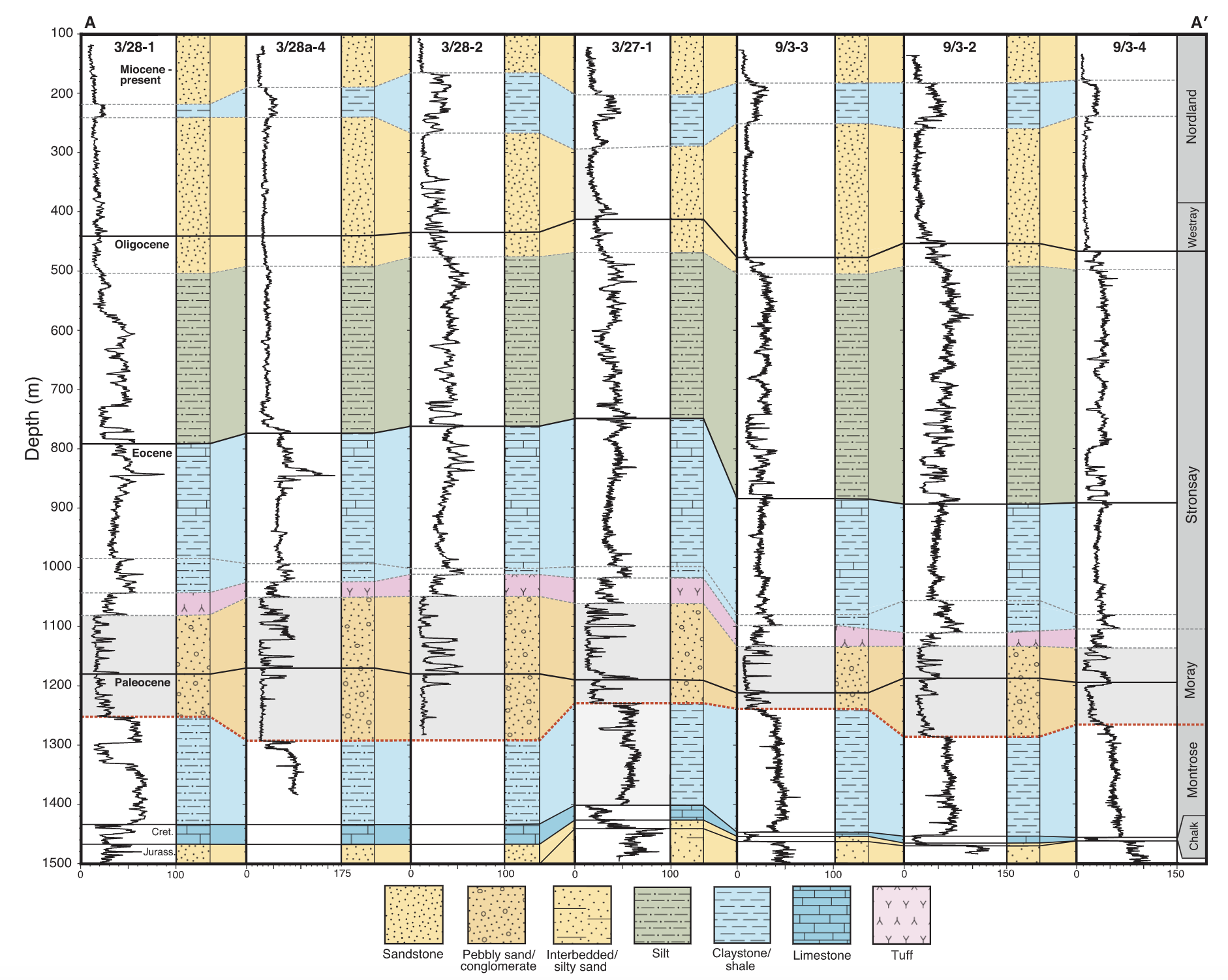
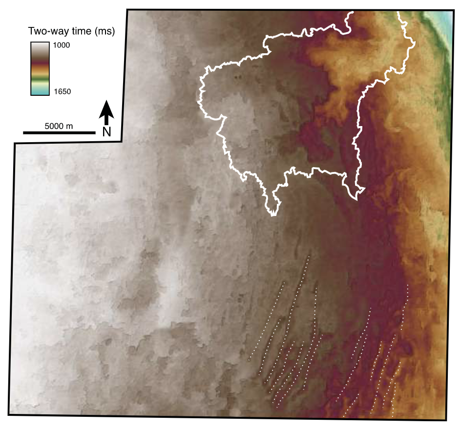
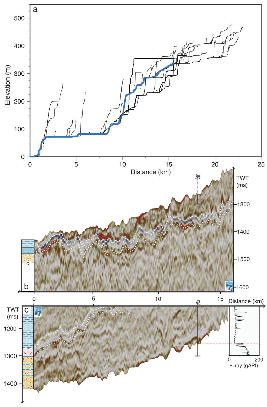
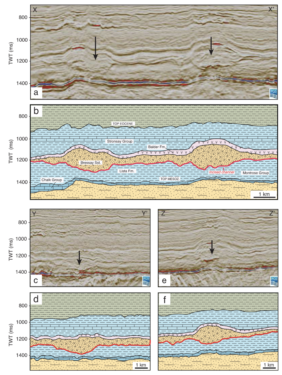
Geodynamic generation of a Paleocene-Eocene landscape buried beneath North Bressay, North Sea – Journal of the Geological Society
Gaia Stucky de Quay & Gareth G. Roberts
Beneath the North Atlantic Ocean, there are likely thousands of (now buried) landscapes that used to be at the surface of the Earth. In 2017 we reported one such landscape; here we identify and map an even bigger, and more spectacular landscape. Now several hundred meters below the seabed, this region in the North Bressay used to host an extensive river system, with evidence for meandering channels, avulsions, and even deltaic deposits. And with seismic data we can see it all, preserved for more than 50 million years!
– 2022 –
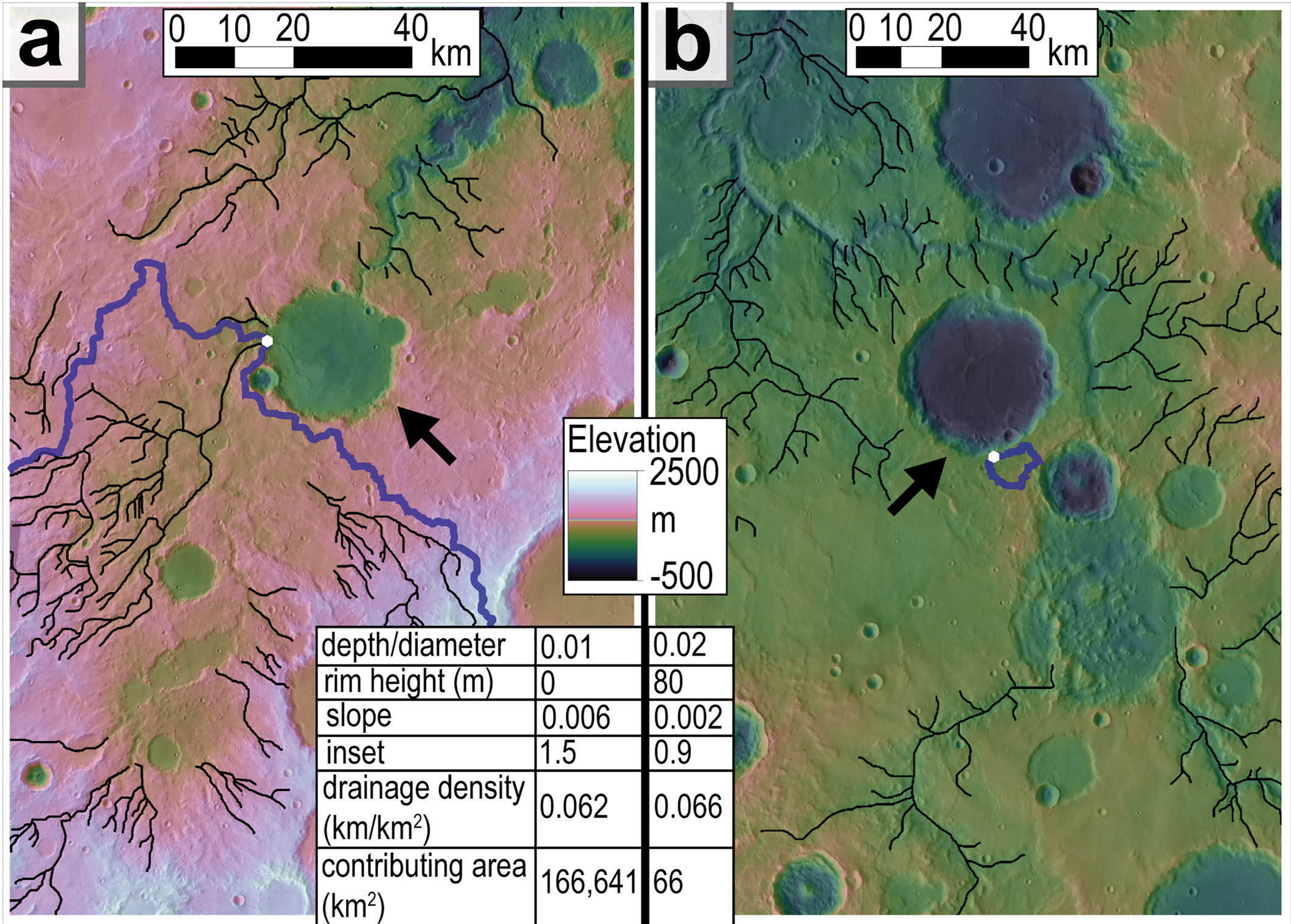
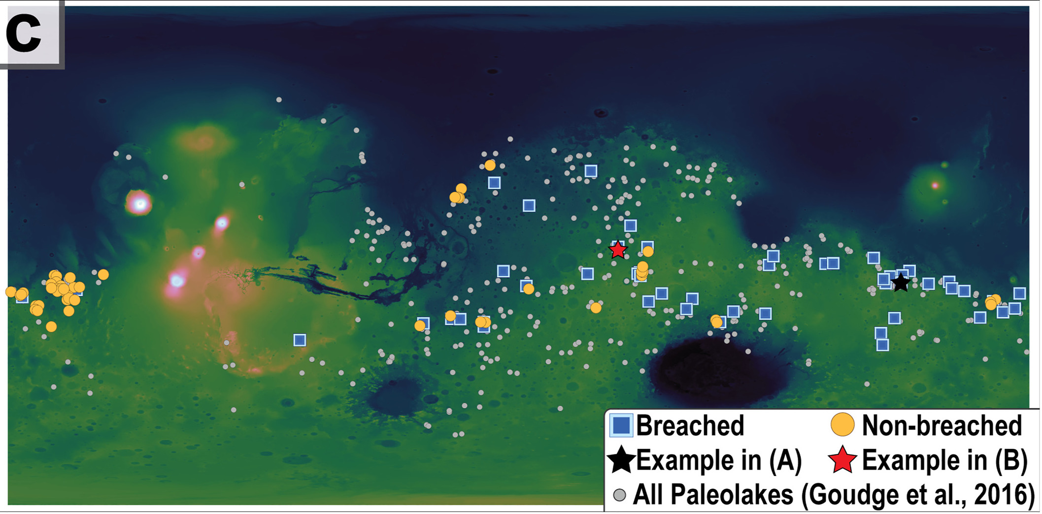
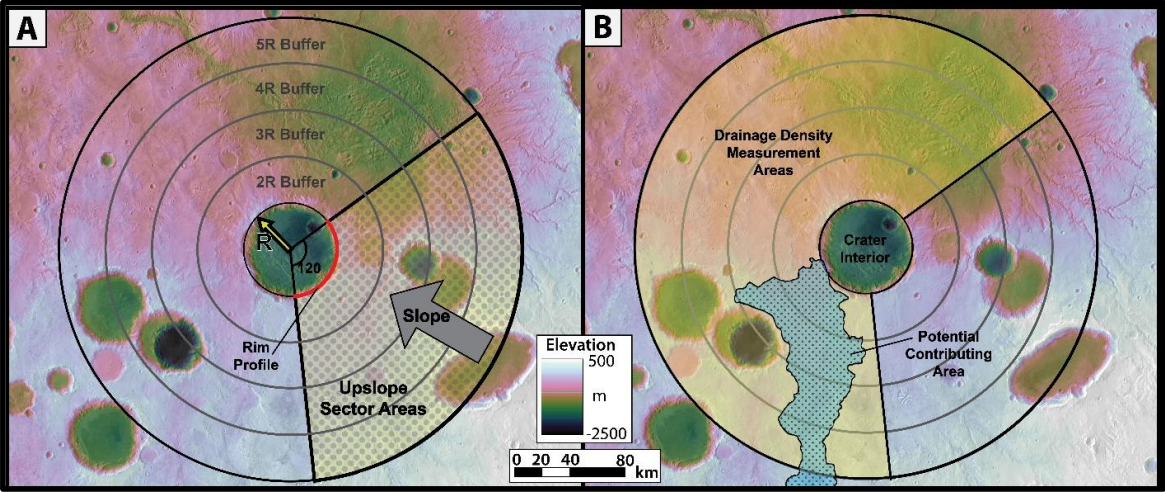
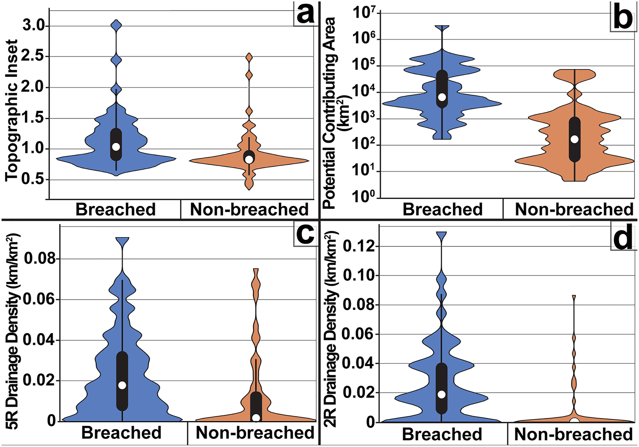
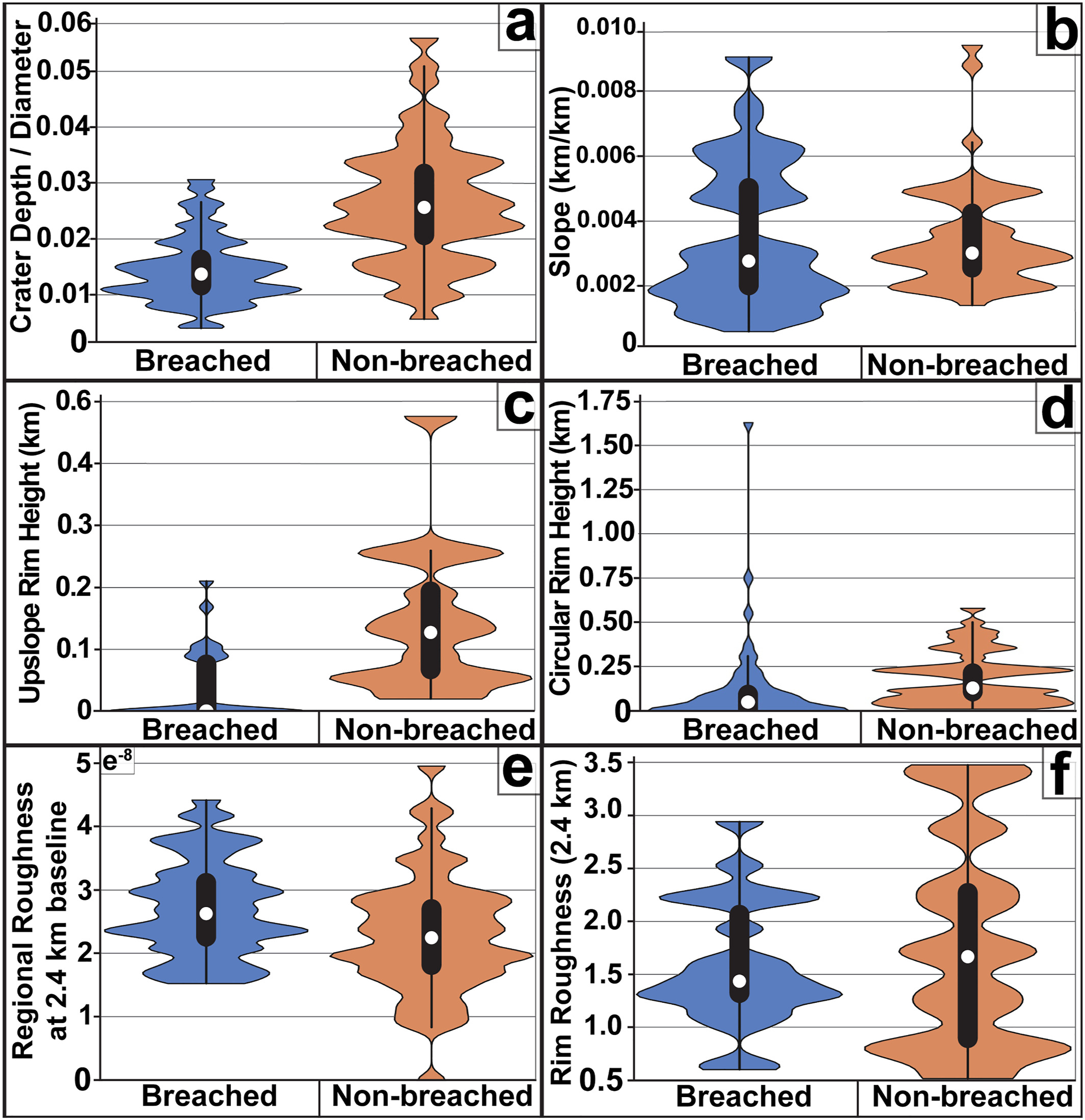
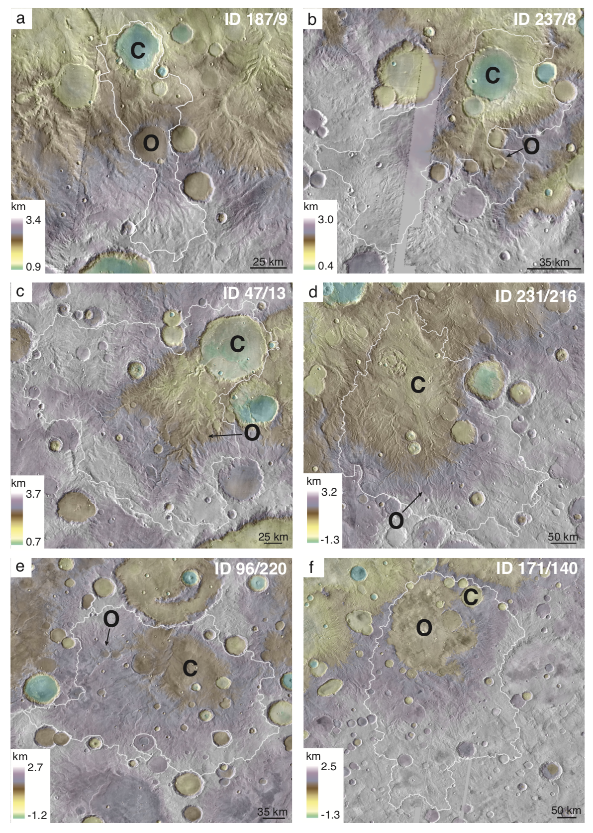
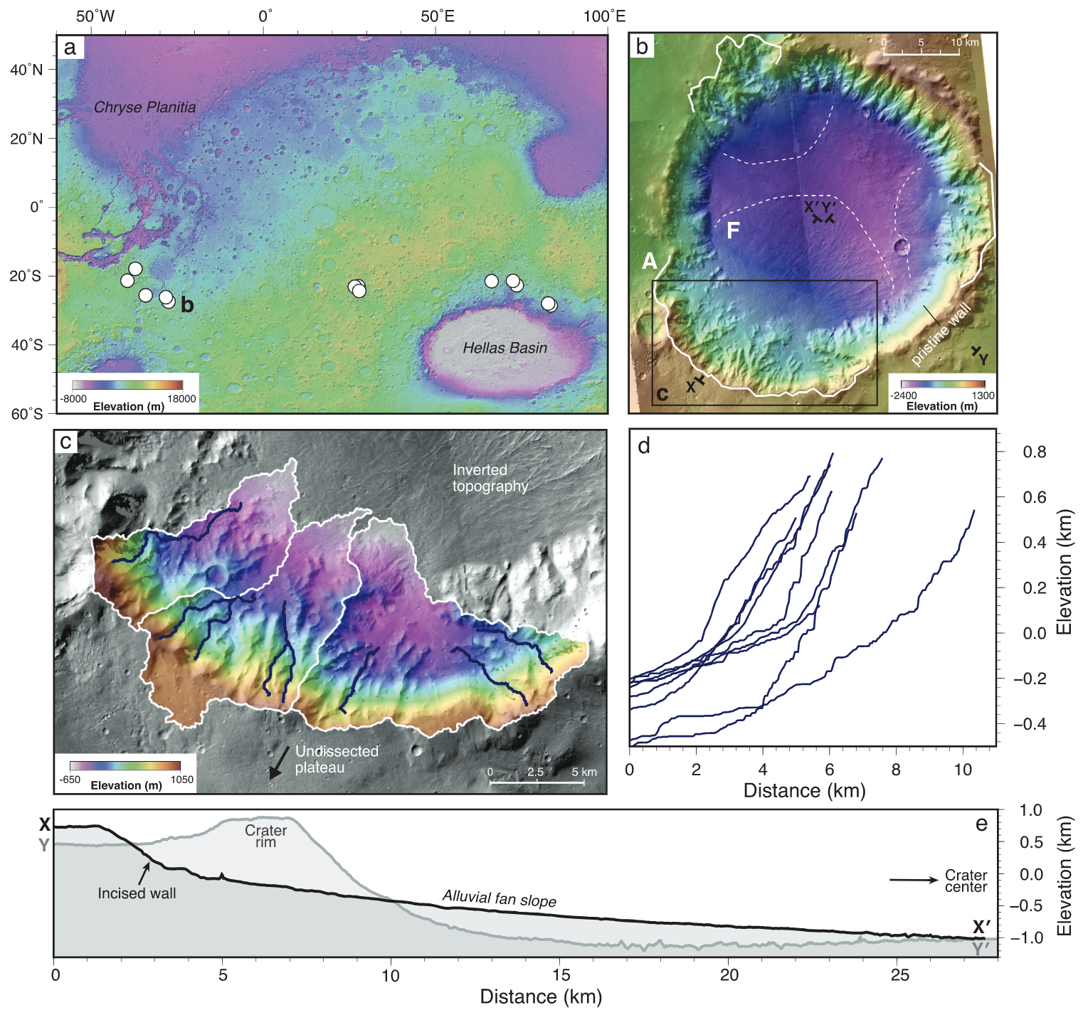
Paleolake Inlet Valley Formation: Factors Controlling Which Craters Breached on Early Mars – GRL
Emily Bamber, Tim Goudge, (…) & Gaia Stucky de Quay
Many of Mars’ craters used to host lakes. But to collect surface water, you need rivers to be able to cut over crater rims, allowing the water to flow unhindered into the crater. Luckily, very old (Noachian) craters don’t have high rims… so water should be able to flow in easily, right? And yet – not all older craters have rivers flowing into them, only a few. Why does this happen? What are the factors that control why or why not a river flows into a crater? Emily looks into various topographic and hydrologic factors to answer this exact question!
– 2021 –
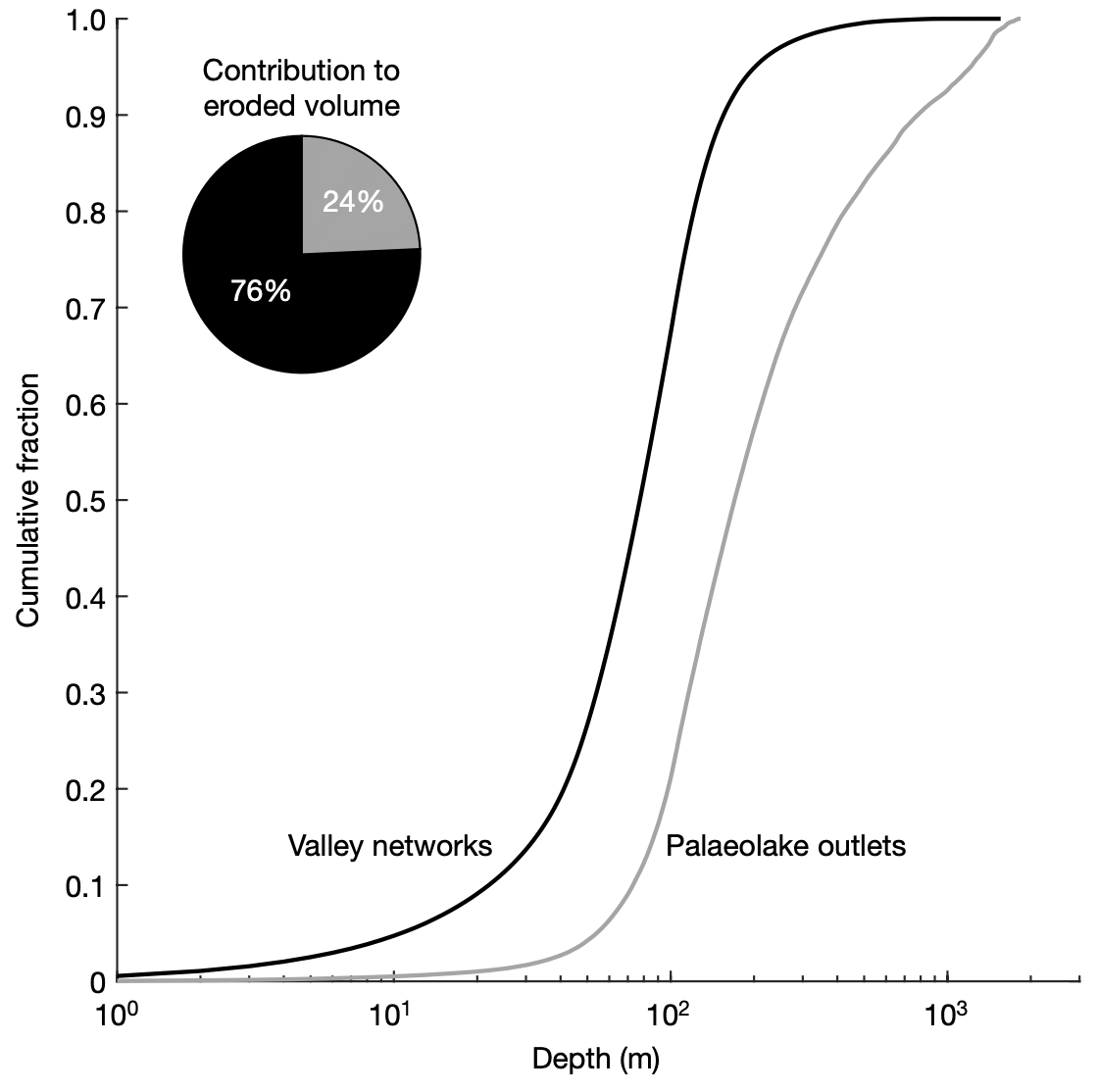
The importance of lake breach floods for valley incision on early Mars – Nature
Timothy A. Goudge, Alex M. Morgan, Gaia Stucky de Quay, and Caleb I. Fasset
In this project, we demonstrated the global importance of lake breach flooding on early Mars. By calculating erosional volumes globally using topographic data, we found that they were responsible for eroding at least 24% of the volume of incised valleys on early Mars — a huge amount! This likely influenced the topographic form of many valley systems and the broader landscape of the southern highlands on Mars.
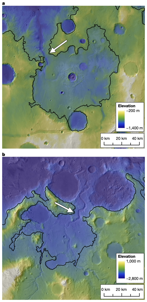
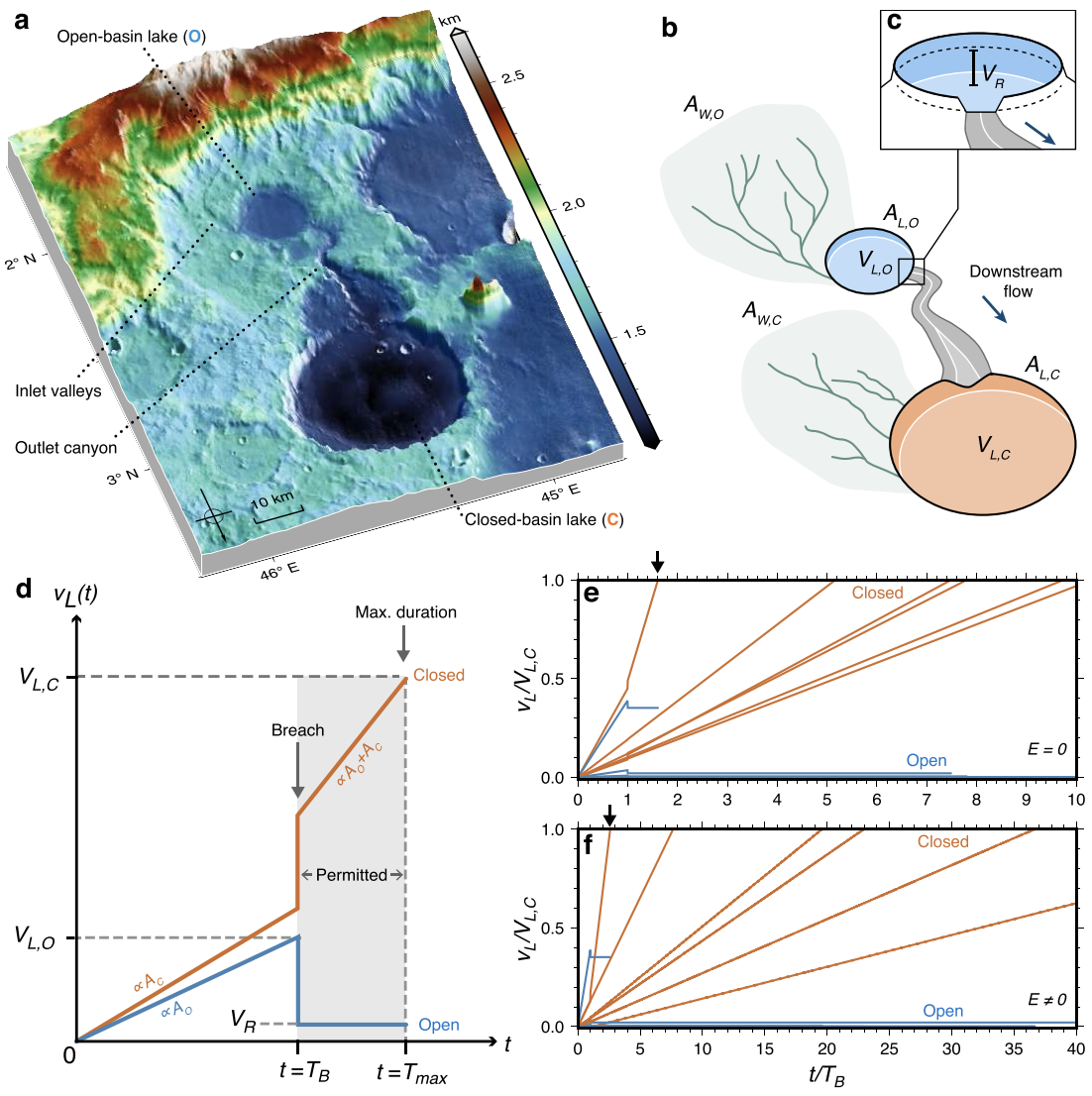
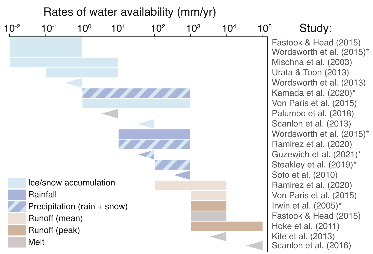
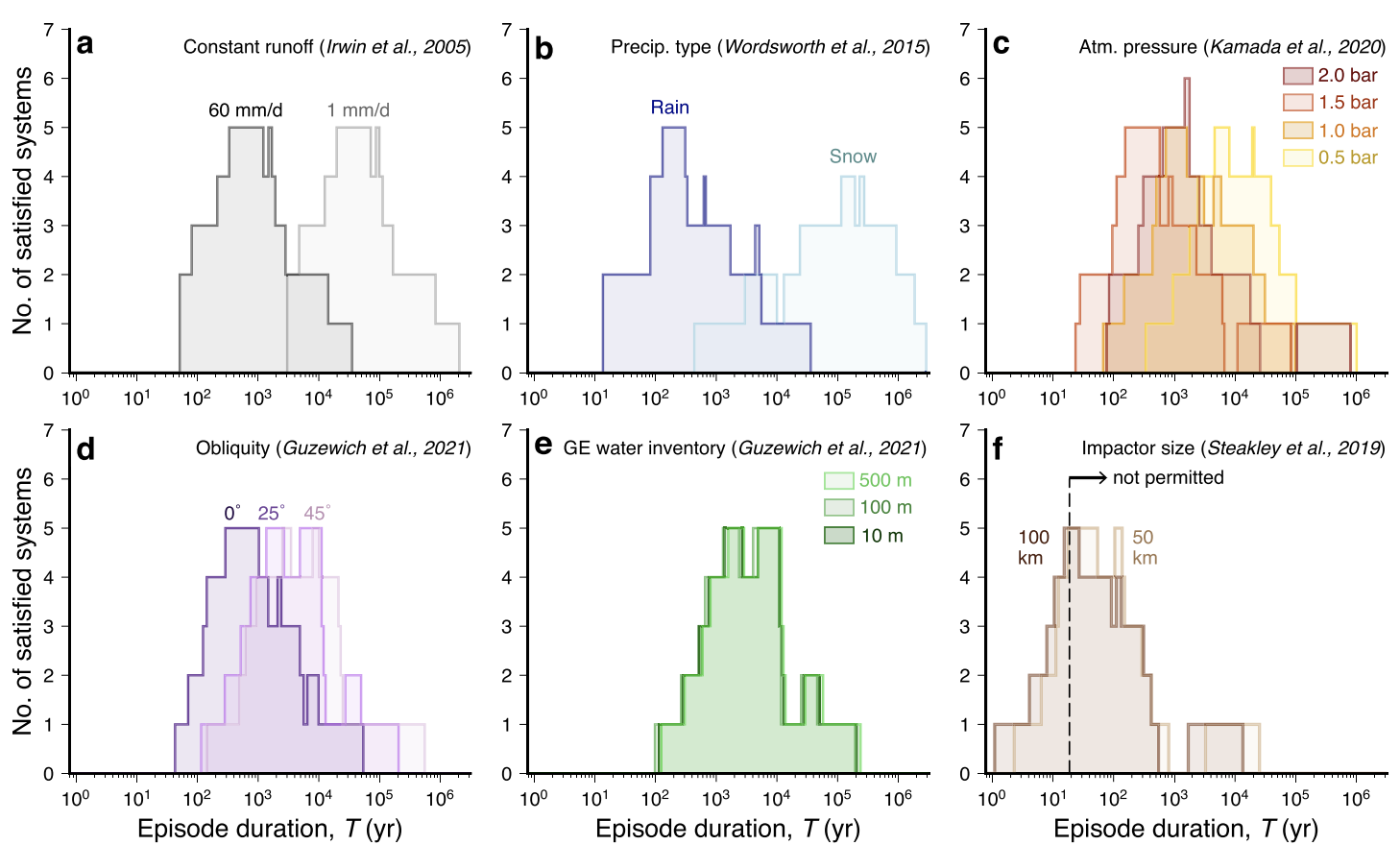
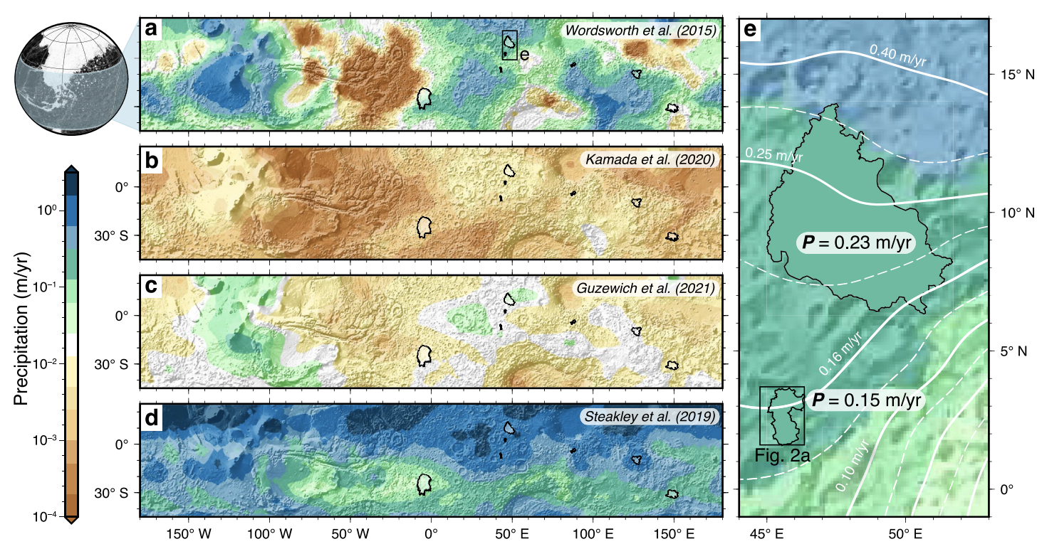
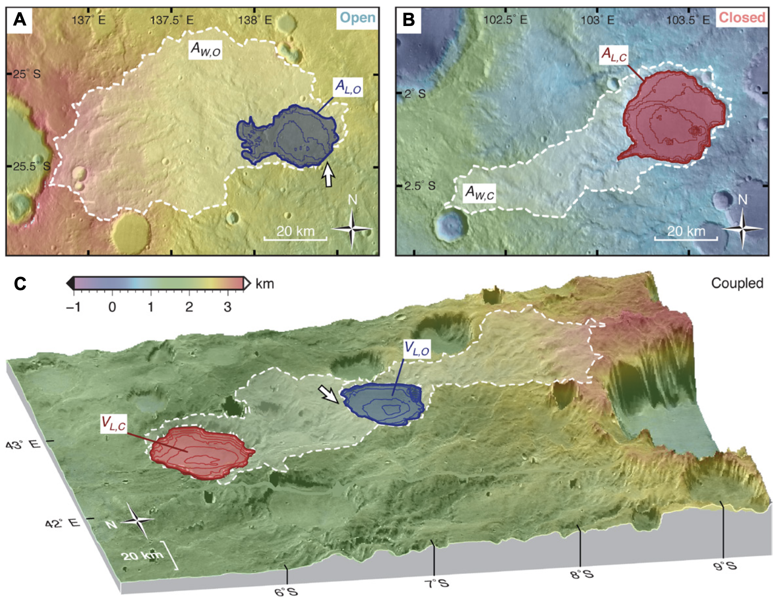
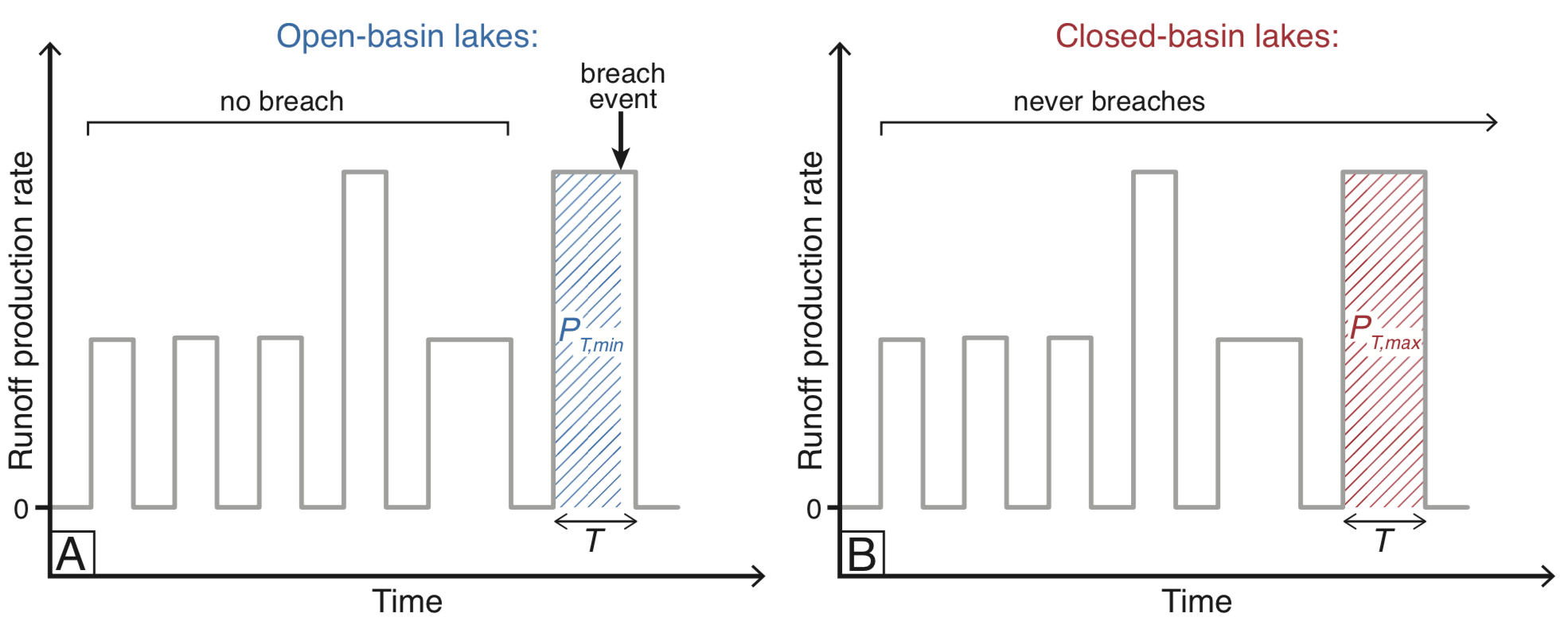
Limits on runoff episode duration for early Mars: Integrating lake hydrology and climate models – Geophys. Res. Lett.
Gaia Stucky de Quay, Timothy A. Goudge, Edwin S. Kite, Scott D. Guzewich, and Caleb I. Fasset
Here we sought to answer a fundamental question for early Mars climate: what was the duration of individual runoff-producing episodes? We use newly identified “coupled” lake systems. By combining morphology measurements with precipitation from previous climate models, we found that runoff episodes likely lasted 100–10,000 years, and required many, many cycles.
– 2020 –
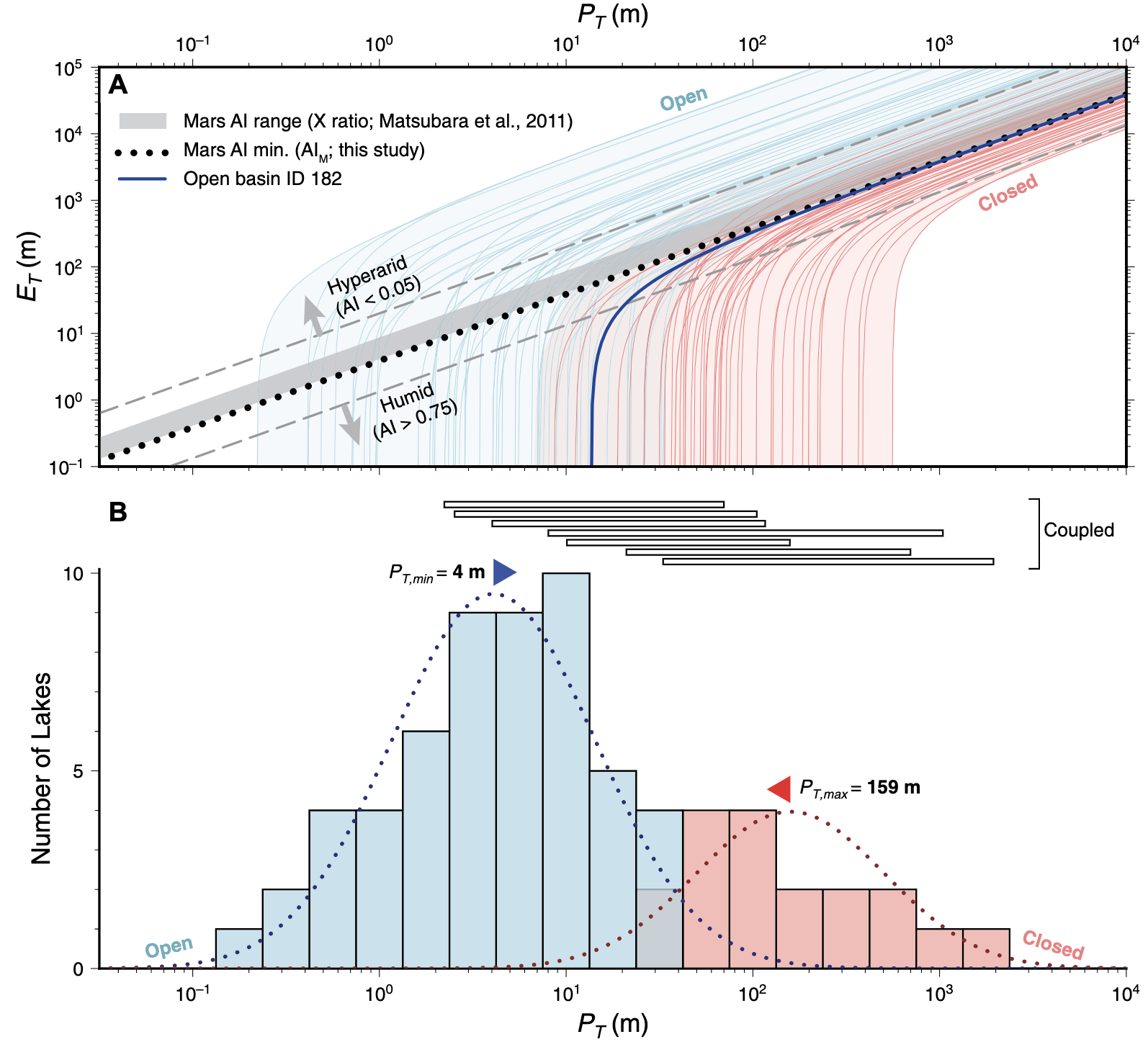
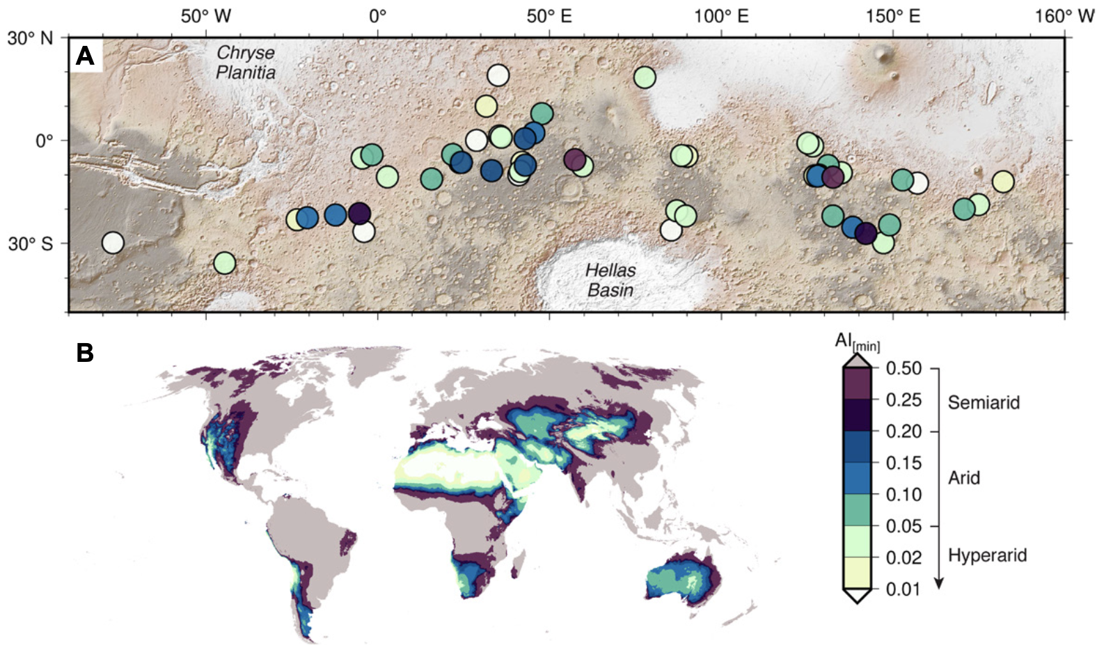
Precipitation and aridity constraints from paleolakes on early Mars – Geology
Gaia Stucky de Quay, Timothy A. Goudge, and Caleb I. Fasset
By making use of a database of almost 100 open- and closed-basin lakes on Mars, we show that the basin-averaged precipitation was between 4 and 159 m. Aridities resembled semi-arid locations like the Great Basin, USA, and could have been even more humid! These quantitative results are important as they can be used to test paleoclimate models and figure out Mars’ ancient climate, and provide context for future missions in paleolakes (e.g., Perseverance!).
– 2019 –
Prolonged fluvial activity from channel-fan systems on Mars – JGR: Planets
Gaia Stucky de Quay, Edwin S. Kite, and David P. Mayer
In this study, Mars crater rim channels that source alluvial fans (> 1 billion years old) were mapped and analyzed using erosion and sediment transport models. These key source-to-sink features allowed us to determine that total fluvial activity was likely between 100 years to 1 million years, excluding periods of dryness. Fluvial geometries, distributions, and geomorphic observations suggest an overall arid environment during formation.


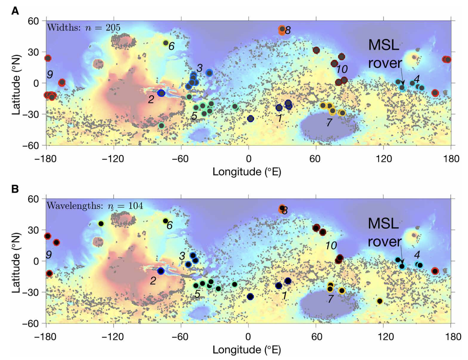
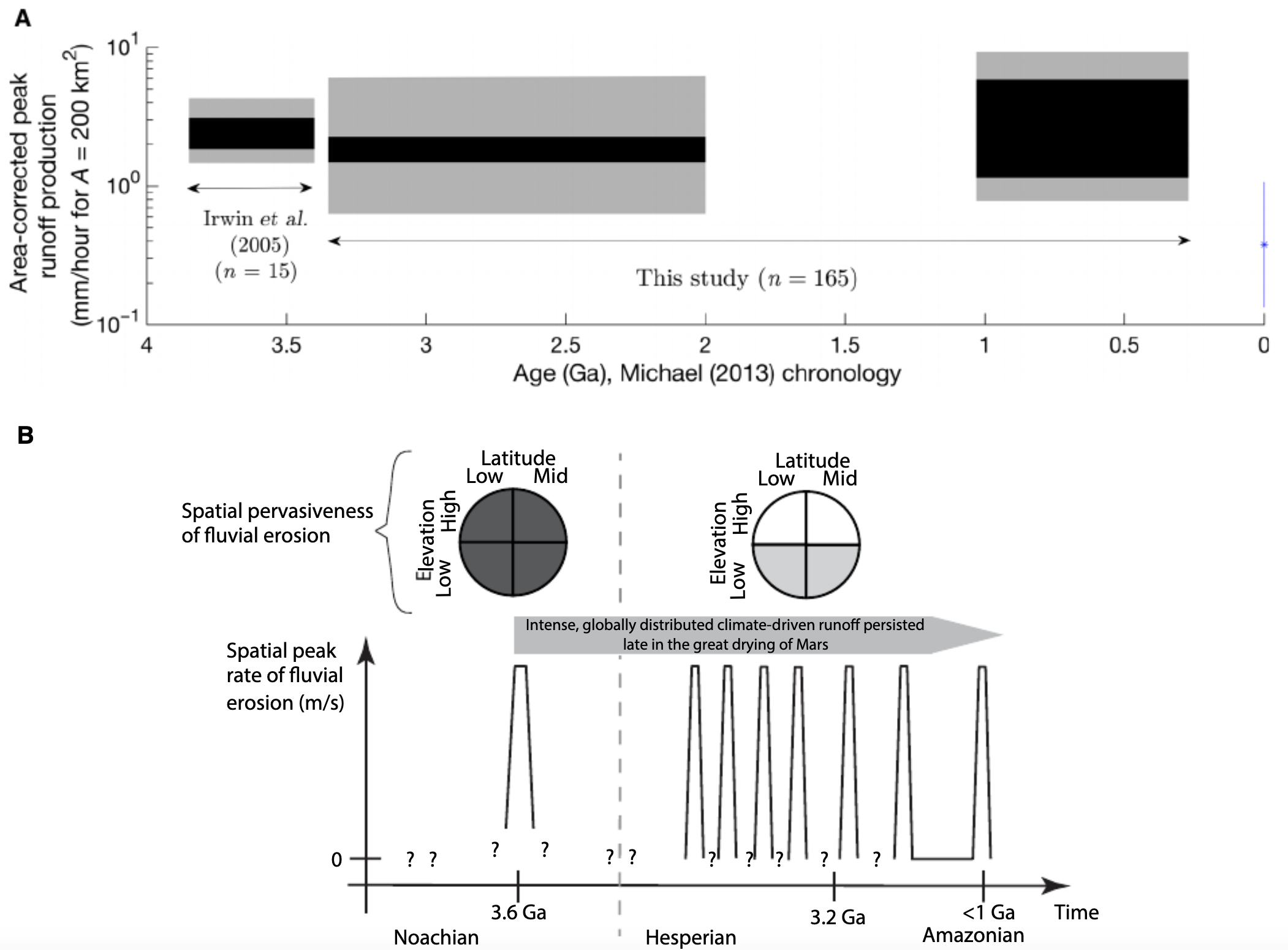
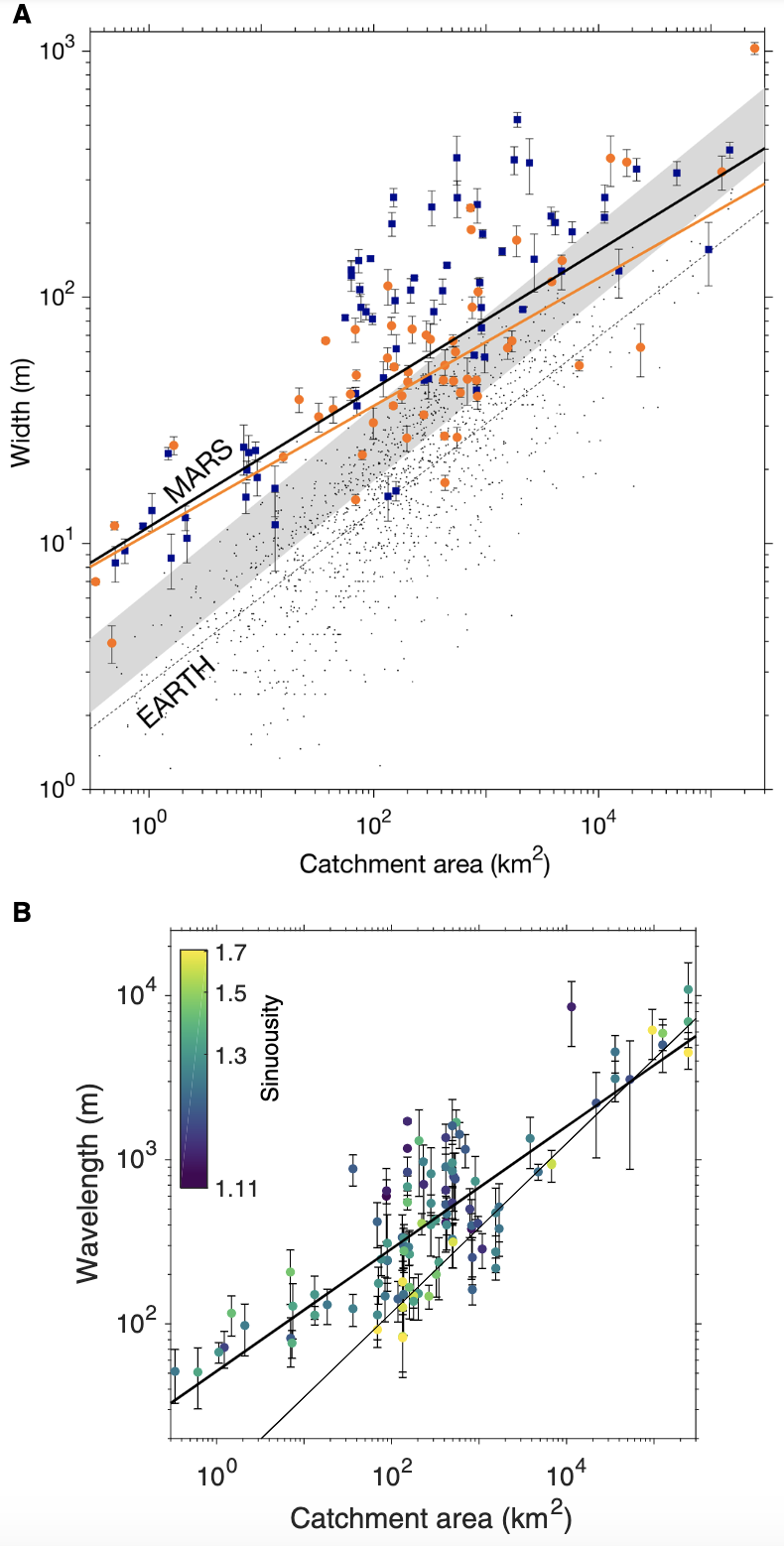
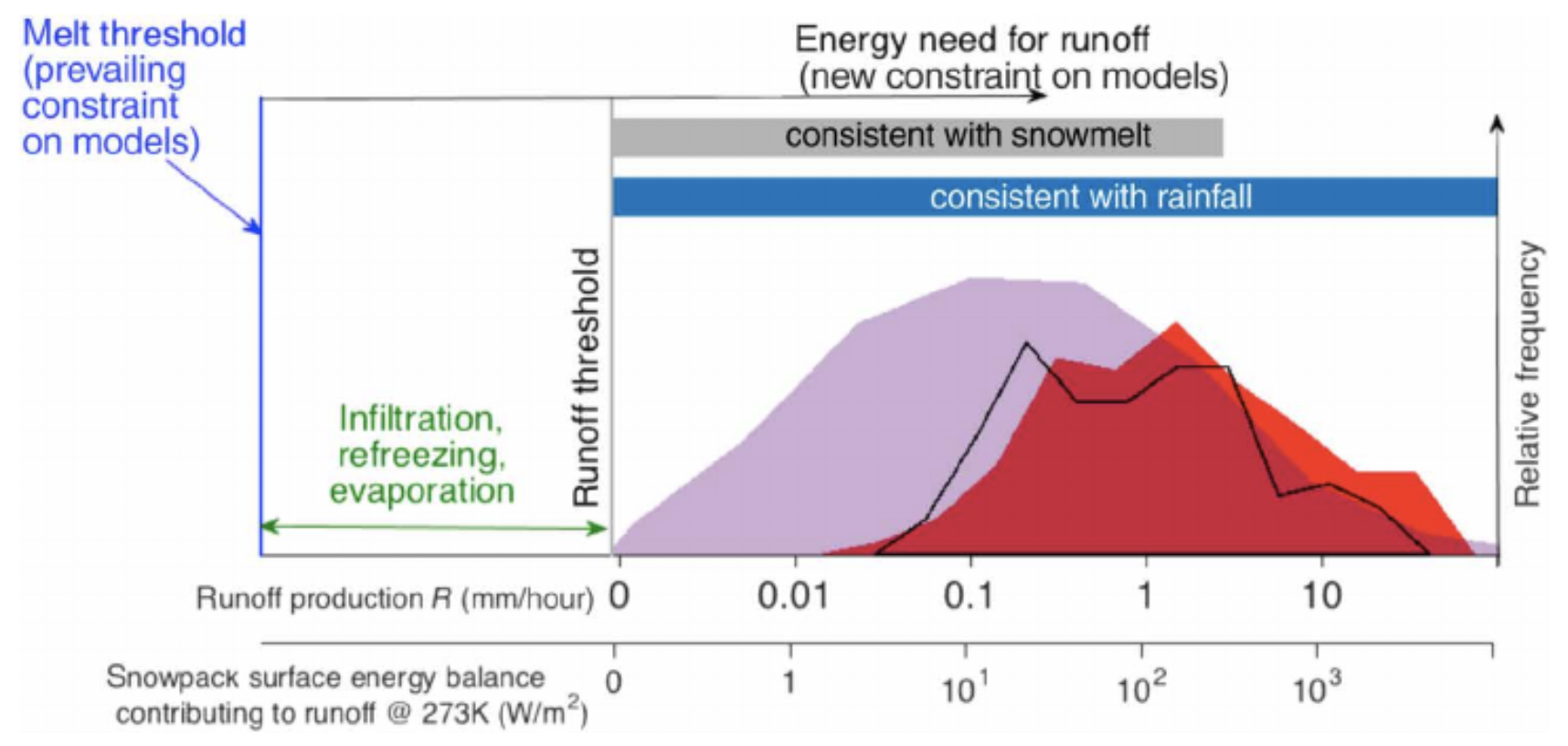
Persistence of intense, climate-driven runoff late in Mars history – Science Advances
Edwin S. Kite, David P. Mayer, Sharon A. Wilson, Joel M. Davis, Antoine S. Lucas, and Gaia Stucky de Quay
Using the scale (widths and wavelengths) of late-stage paleochannels on Mars, we determined that surface runoff production was much greater, and occurred much later into its history, than was originally thought. Possibly even up until 1 billion years ago (which is recent – for Mars standard at least)! This has important implications for habitability and our understanding of how Mars’ climate ultimately declined, and places new constraints on the unknown mechanism that caused wet climates.

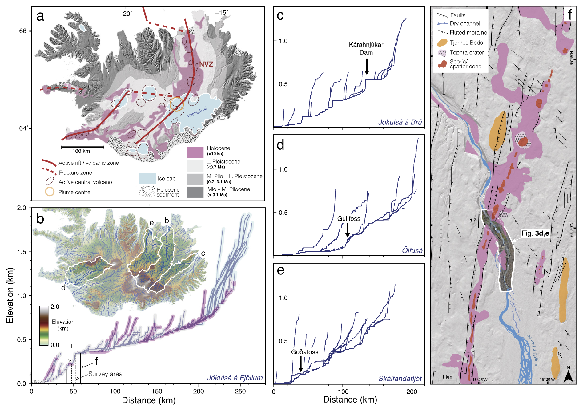
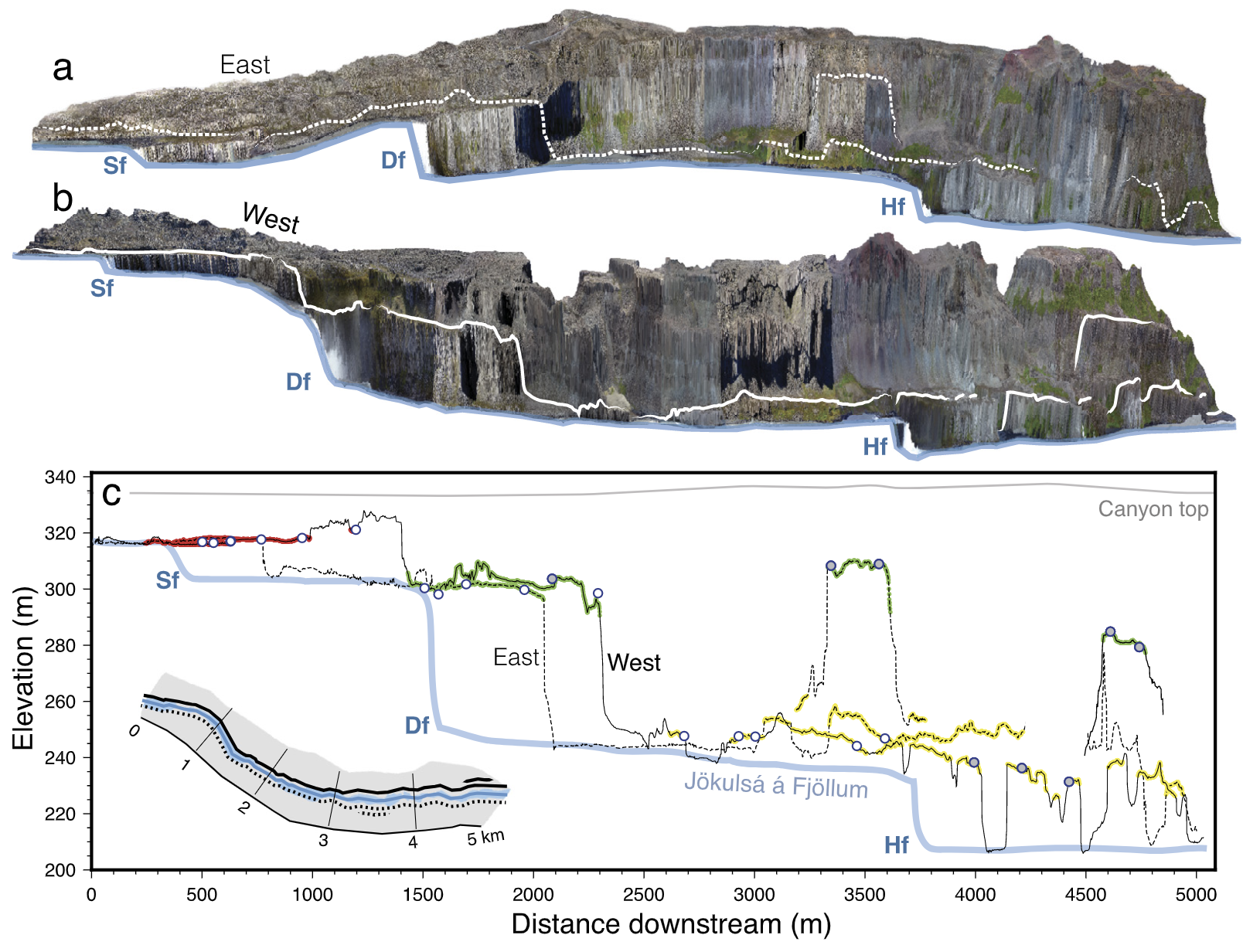
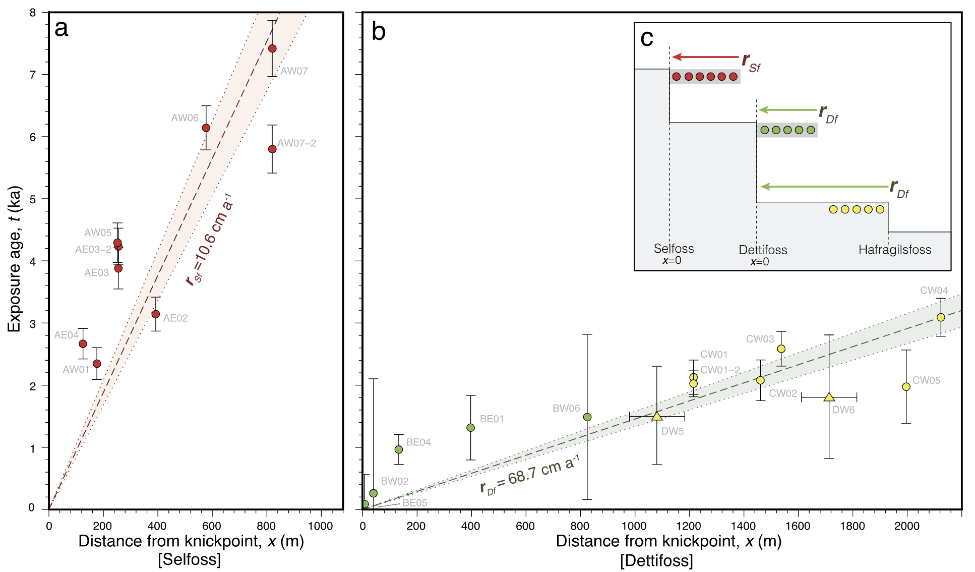
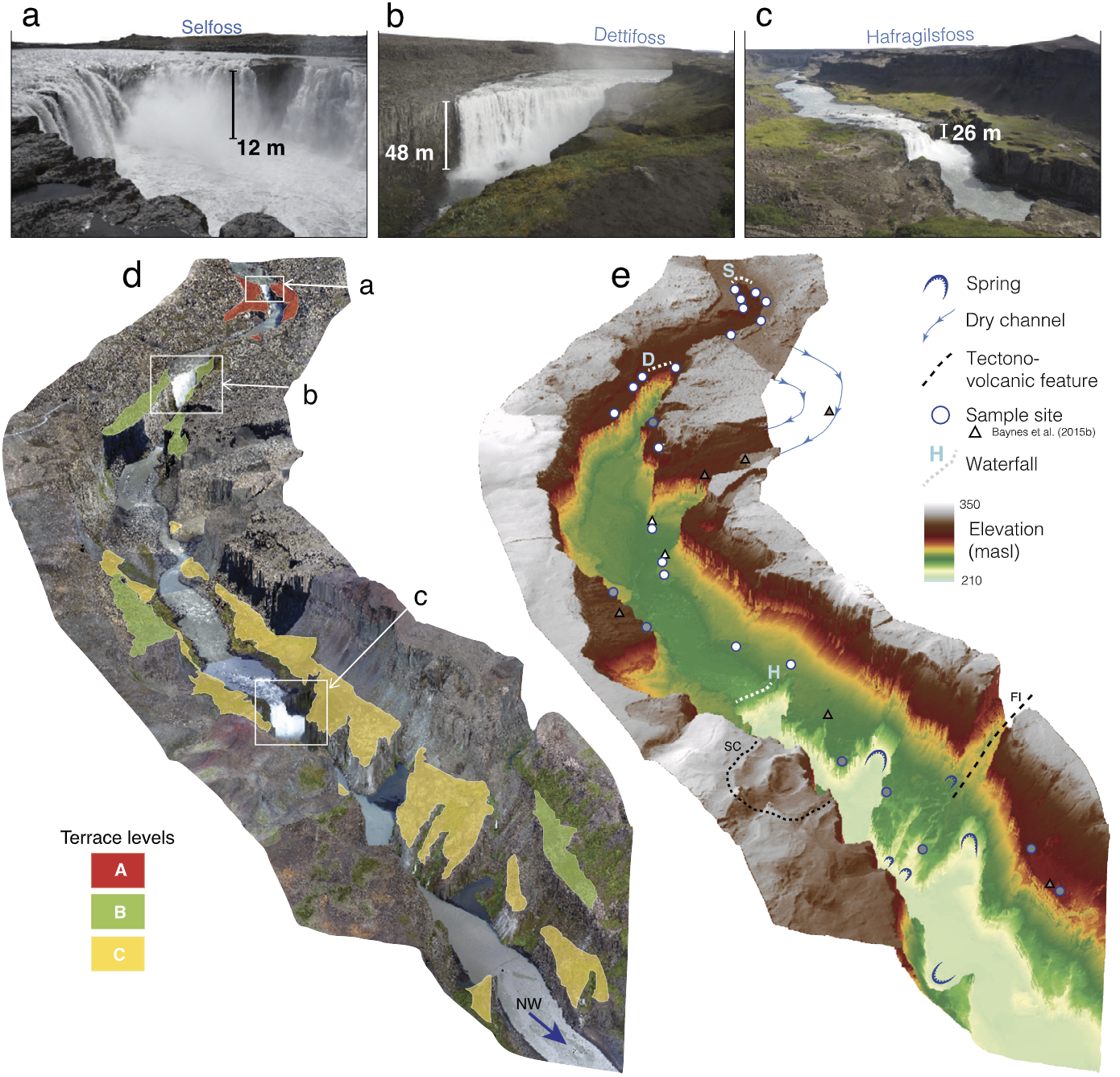
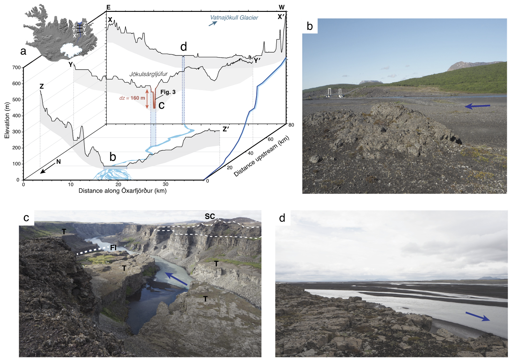
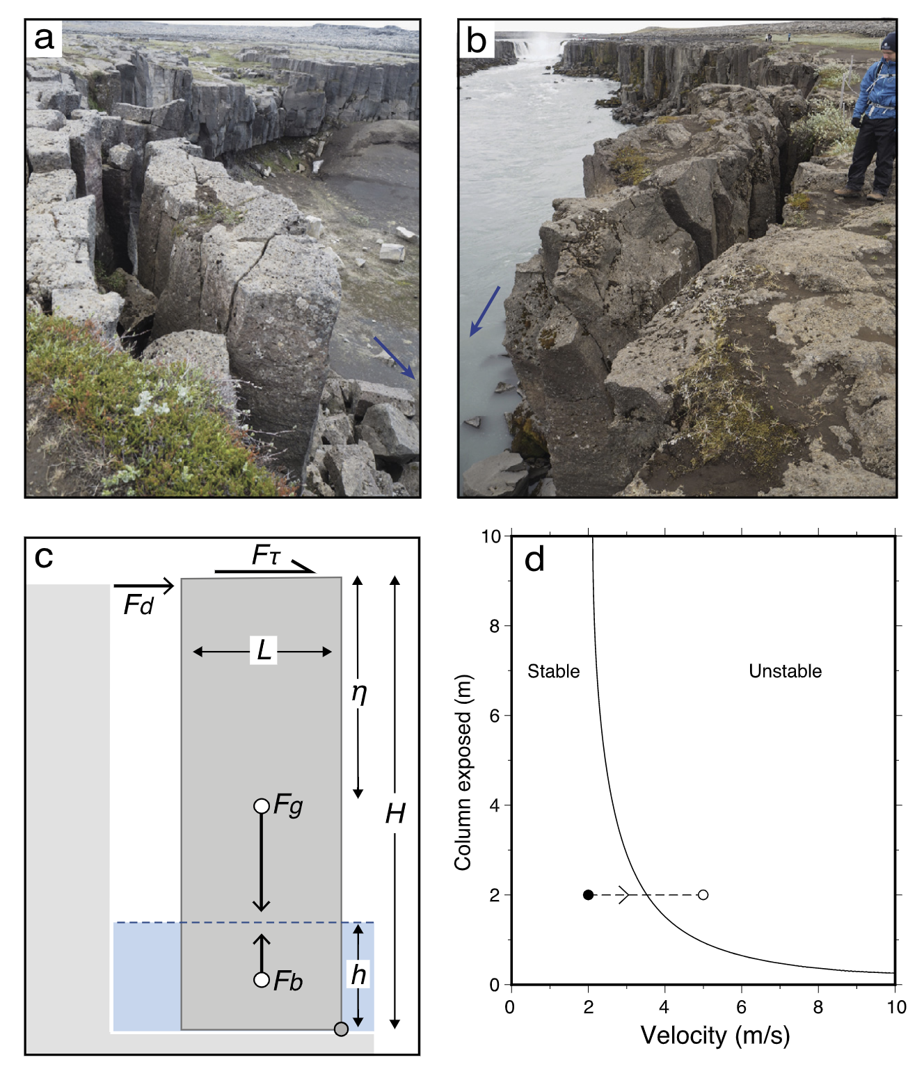
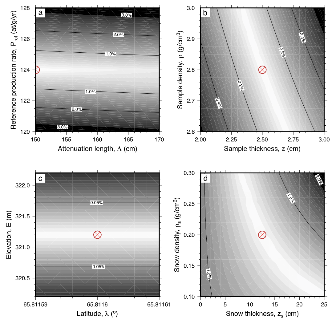
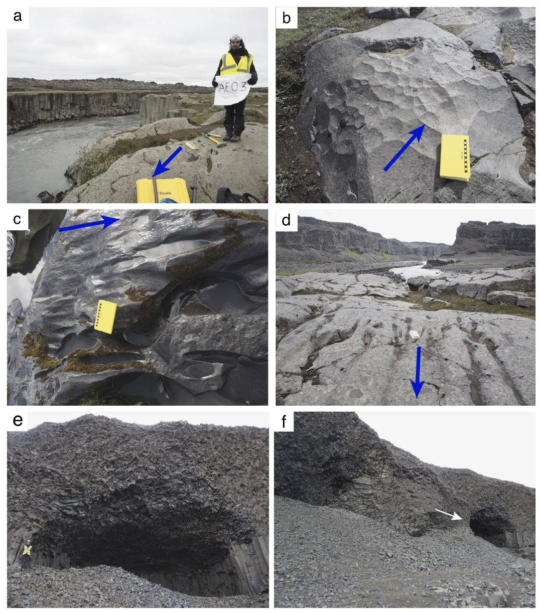
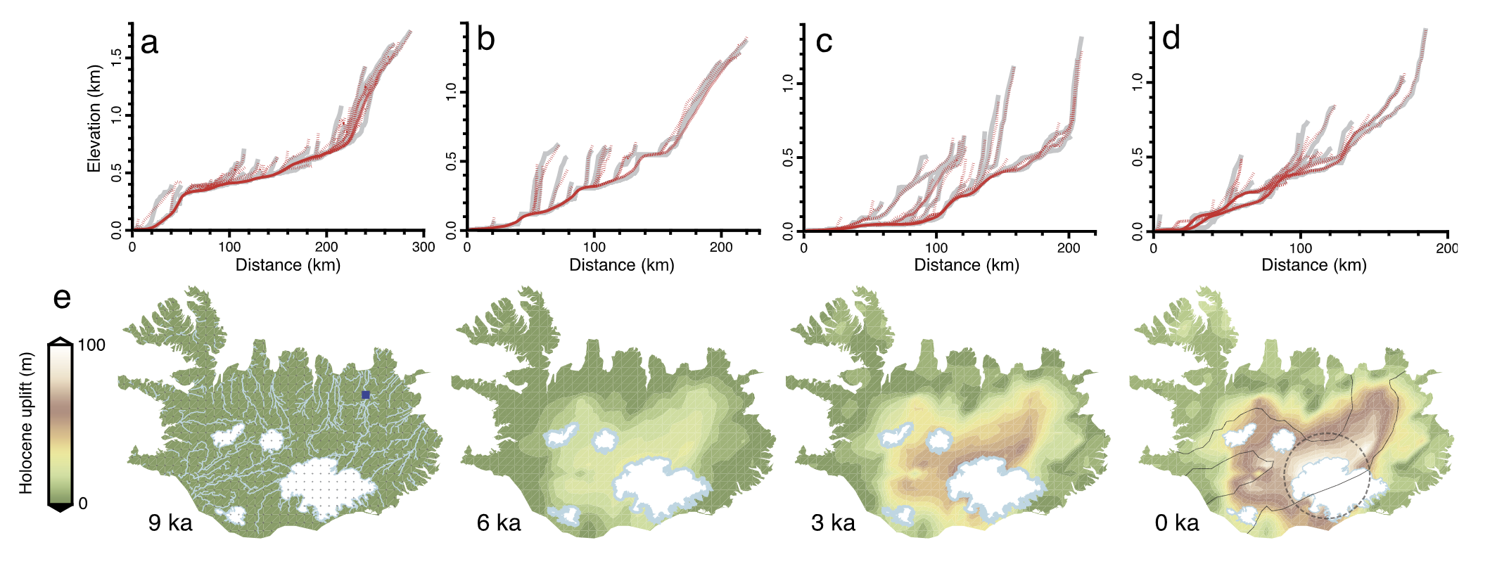
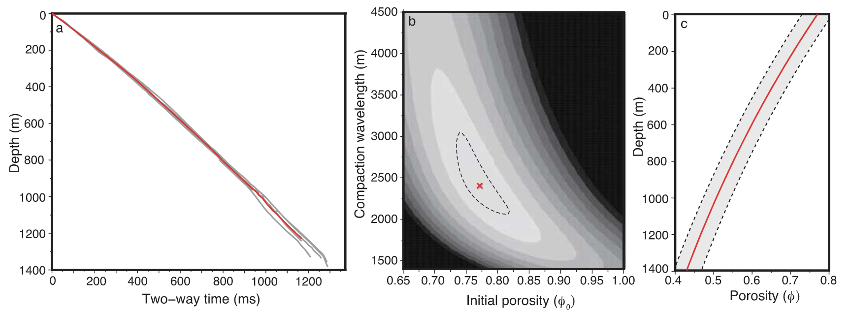
Holocene uplift and rapid fluvial erosion of Iceland: A record of post-glacial landscape evolution – Earth & Plan. Sci. Lett.
Gaia Stucky de Quay, Gareth G. Roberts, Dylan H. Rood, and Victoria M. Fernandes
For this project, we went on an expedition to northeastern Iceland. We used drone and geochronological tools (cosmogenic Helium-3) to quantify the erosional history of the second largest waterfall in Europe (Dettifoss, Iceland). Our results suggest the entire canyon that hosts the waterfall complex was formed progressively over several thousands of years, as opposed to only through a few catastrophic events, as previously suggested. Significant uplift and postglacial erosion played a key role in shaping the island, and fluvial erosion generates up to 100 m of relief locally, as shown using our 3D landscape evolution inversion models.
-2017 –
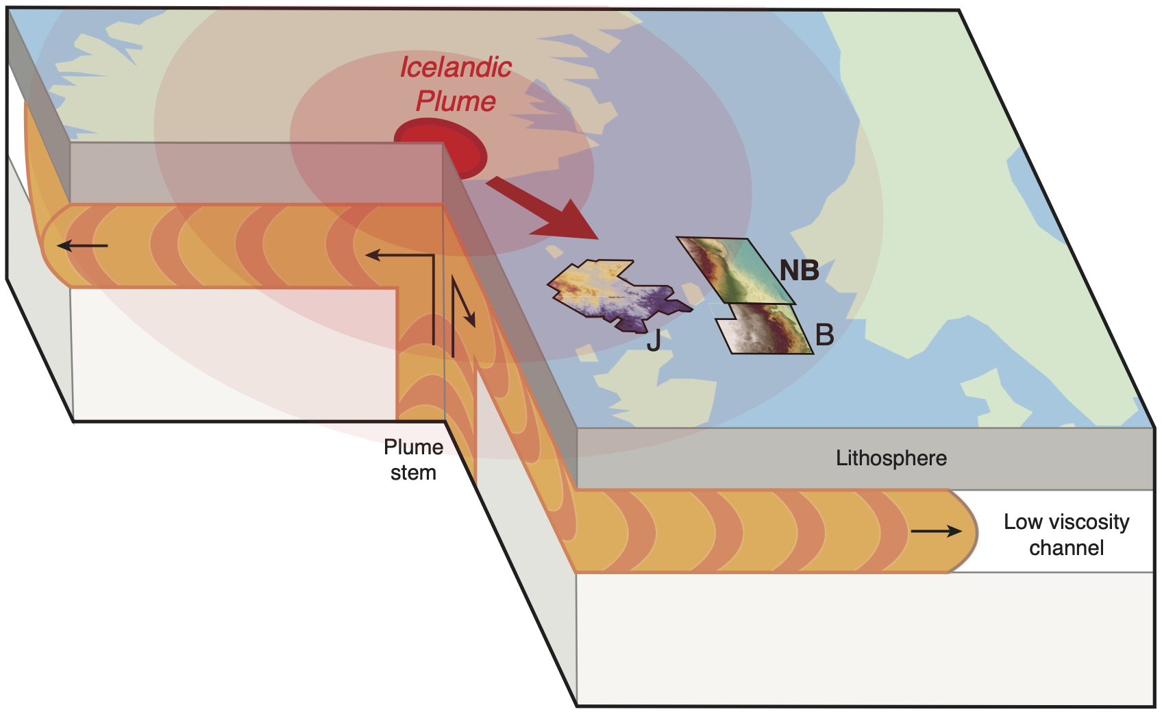
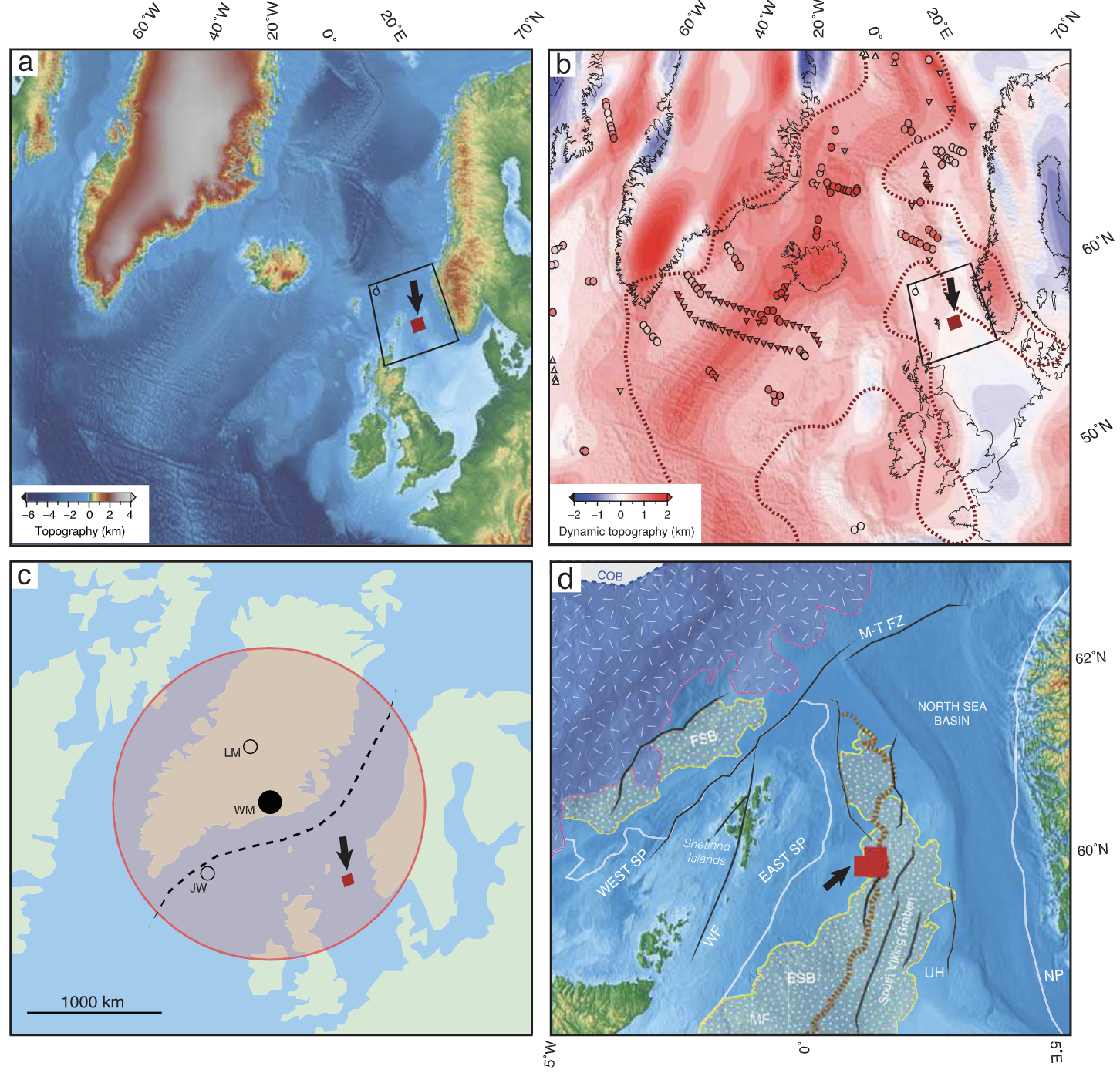
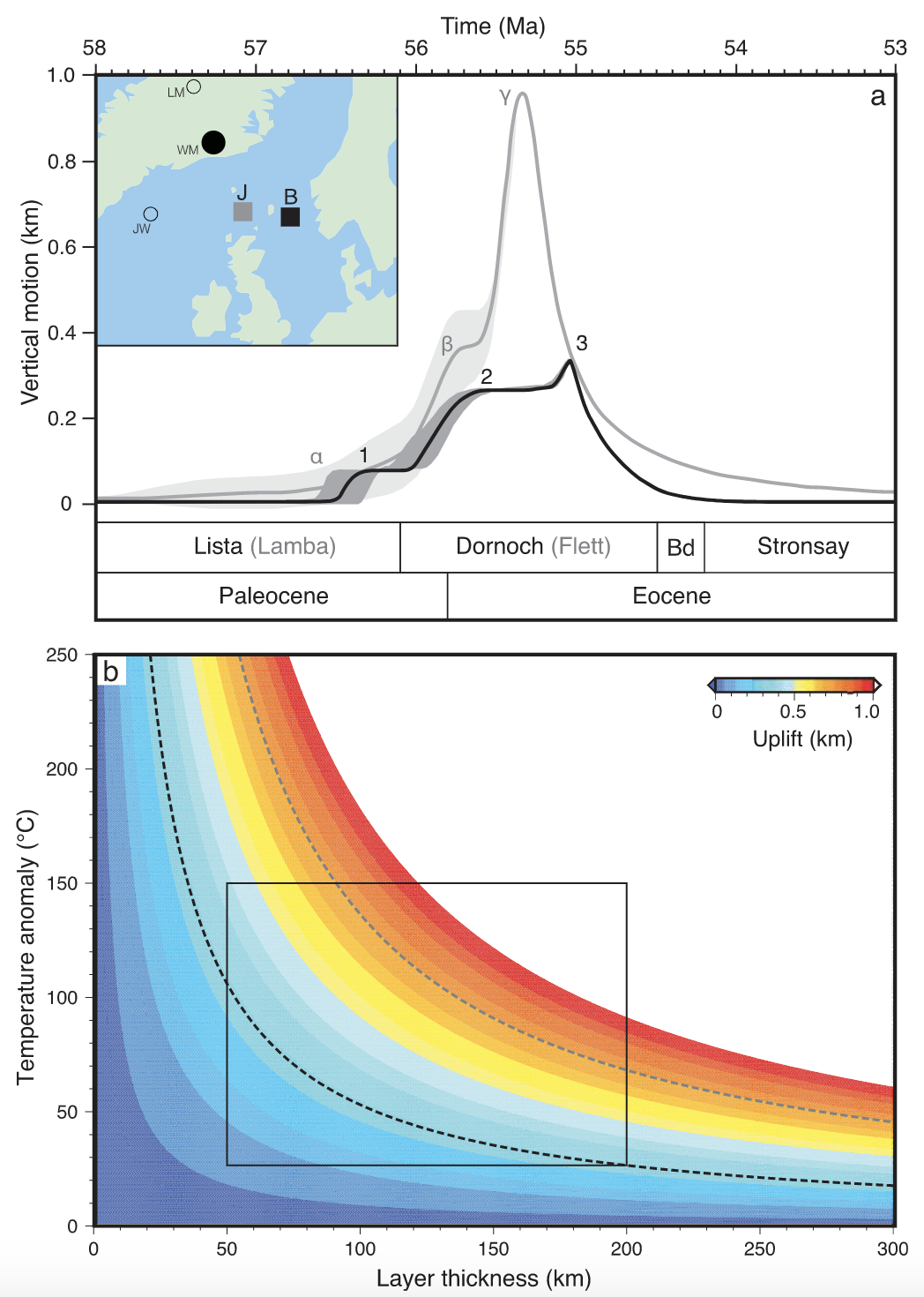
Incipient mantle plume evolution: Constraints from ancient landscapes buried beneath the North Sea – G-Cubed
Gaia Stucky de Quay, Gareth G. Roberts, Jonathan S. Watson, and Christopher A.-L. Jackson.
In my first PhD project, we mapped an ancient landscape buried 1.5 km below the seabed in the North Sea, using 3D seismic data, biostratigraphy, well data, and geochemical analyses of cores. We modeled how this surface was uplifted, subaerially exposed, eroded, and subsequently buried, during the initiation of the Icelandic mantle plume at the Paleocene-Eocene Thermal Maximum. Our results are consistent with an Icelandic plume that was pulsing and creating myriad subaerial landscapes across the North Atlantic Ocean.

In the works…
The following manuscripts have been submitted and are undergoing peer-review. Check back in soon to see the final published version!
